You are here: Home > Network List > AV - Alaska Volcano Observatory Stations List
> Station SPCR Ckakachatna River, Mount Spurr, Alaska > Earthquake Result Viewer
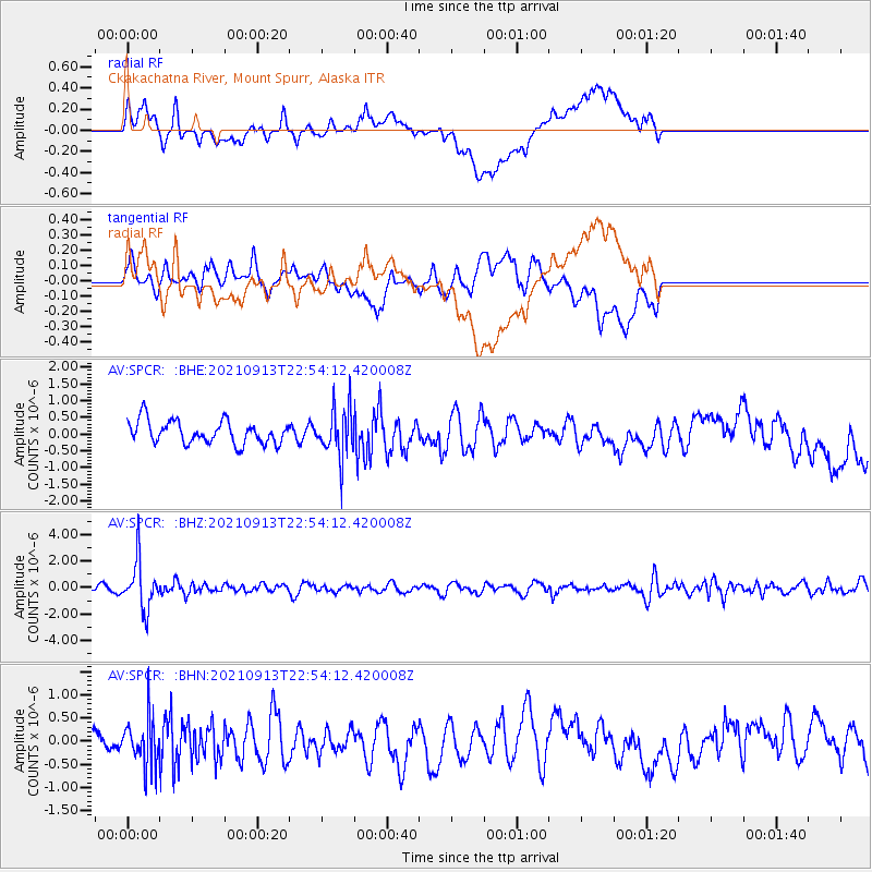
SPCR Ckakachatna River, Mount Spurr, Alaska - Earthquake Result Viewer
*The percent match for this event was below the threshold and hence no stack was calculated.
| Earthquake location: |
Southeast Of Honshu, Japan |
| Earthquake latitude/longitude: |
32.4/137.9 |
| Earthquake time(UTC): |
2021/09/13 (256) 22:46:06 GMT |
| Earthquake Depth: |
376 km |
| Earthquake Magnitude: |
5.9 Mww |
| Earthquake Catalog/Contributor: |
NEIC PDE/us |
|
| Network: |
AV Alaska Volcano Observatory |
| Station: |
SPCR Ckakachatna River, Mount Spurr, Alaska |
| Lat/Lon: |
61.20 N/152.21 W |
| Elevation: |
984 m |
|
| Distance: |
52.6 deg |
| Az: |
34.93 deg |
| Baz: |
270.286 deg |
| Ray Param: |
$rayparam |
*The percent match for this event was below the threshold and hence was not used in the summary stack. |
|
| Radial Match: |
48.55373 % |
| Radial Bump: |
400 |
| Transverse Match: |
51.594784 % |
| Transverse Bump: |
400 |
| SOD ConfigId: |
25131211 |
| Insert Time: |
2021-09-27 22:54:49.701 +0000 |
| GWidth: |
2.5 |
| Max Bumps: |
400 |
| Tol: |
0.001 |
|
Signal To Noise
| Channel | StoN | STA | LTA |
| AV:SPCR: :BHZ:20210913T22:54:12.420008Z | 8.733379 | 1.7818714E-6 | 2.0403002E-7 |
| AV:SPCR: :BHN:20210913T22:54:12.420008Z | 1.712803 | 5.153592E-7 | 3.0088643E-7 |
| AV:SPCR: :BHE:20210913T22:54:12.420008Z | 2.106433 | 7.217994E-7 | 3.4266432E-7 |
| Arrivals |
| Ps | |
| PpPs | |
| PsPs/PpSs | |


