You are here: Home > Network List > CI - Caltech Regional Seismic Network Stations List
> Station TIN Tinemaha, Big Pine, CA, USA > Earthquake Result Viewer
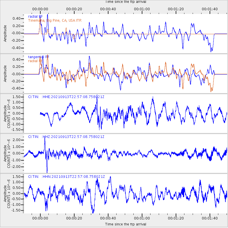
TIN Tinemaha, Big Pine, CA, USA - Earthquake Result Viewer
*The percent match for this event was below the threshold and hence no stack was calculated.
| Earthquake location: |
Southeast Of Honshu, Japan |
| Earthquake latitude/longitude: |
32.4/137.9 |
| Earthquake time(UTC): |
2021/09/13 (256) 22:46:06 GMT |
| Earthquake Depth: |
376 km |
| Earthquake Magnitude: |
5.9 Mww |
| Earthquake Catalog/Contributor: |
NEIC PDE/us |
|
| Network: |
CI Caltech Regional Seismic Network |
| Station: |
TIN Tinemaha, Big Pine, CA, USA |
| Lat/Lon: |
37.05 N/118.23 W |
| Elevation: |
1197 m |
|
| Distance: |
80.9 deg |
| Az: |
51.867 deg |
| Baz: |
303.745 deg |
| Ray Param: |
$rayparam |
*The percent match for this event was below the threshold and hence was not used in the summary stack. |
|
| Radial Match: |
34.54887 % |
| Radial Bump: |
400 |
| Transverse Match: |
62.923122 % |
| Transverse Bump: |
400 |
| SOD ConfigId: |
25131211 |
| Insert Time: |
2021-09-27 22:58:50.331 +0000 |
| GWidth: |
2.5 |
| Max Bumps: |
400 |
| Tol: |
0.001 |
|
Signal To Noise
| Channel | StoN | STA | LTA |
| CI:TIN: :HHZ:20210913T22:57:08.758021Z | 4.018016 | 9.514631E-7 | 2.3679924E-7 |
| CI:TIN: :HHN:20210913T22:57:08.758021Z | 1.2647693 | 5.5657426E-7 | 4.400599E-7 |
| CI:TIN: :HHE:20210913T22:57:08.758021Z | 1.4827161 | 6.2955945E-7 | 4.2459877E-7 |
| Arrivals |
| Ps | |
| PpPs | |
| PsPs/PpSs | |


