You are here: Home > Network List > UU - University of Utah Regional Network Stations List
> Station FORU South Mineral Mountains, UT, USA > Earthquake Result Viewer
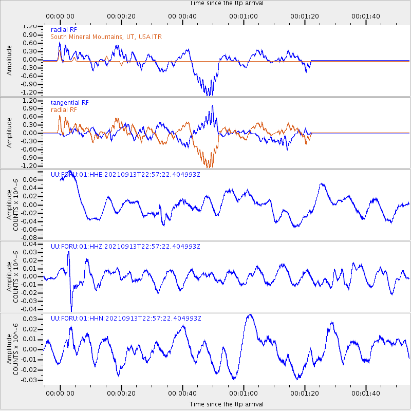
FORU South Mineral Mountains, UT, USA - Earthquake Result Viewer
*The percent match for this event was below the threshold and hence no stack was calculated.
| Earthquake location: |
Southeast Of Honshu, Japan |
| Earthquake latitude/longitude: |
32.4/137.9 |
| Earthquake time(UTC): |
2021/09/13 (256) 22:46:06 GMT |
| Earthquake Depth: |
376 km |
| Earthquake Magnitude: |
5.9 Mww |
| Earthquake Catalog/Contributor: |
NEIC PDE/us |
|
| Network: |
UU University of Utah Regional Network |
| Station: |
FORU South Mineral Mountains, UT, USA |
| Lat/Lon: |
38.46 N/112.86 W |
| Elevation: |
1840 m |
|
| Distance: |
83.6 deg |
| Az: |
48.239 deg |
| Baz: |
306.531 deg |
| Ray Param: |
$rayparam |
*The percent match for this event was below the threshold and hence was not used in the summary stack. |
|
| Radial Match: |
65.77627 % |
| Radial Bump: |
370 |
| Transverse Match: |
54.6759 % |
| Transverse Bump: |
400 |
| SOD ConfigId: |
25131211 |
| Insert Time: |
2021-09-27 23:11:19.485 +0000 |
| GWidth: |
2.5 |
| Max Bumps: |
400 |
| Tol: |
0.001 |
|
Signal To Noise
| Channel | StoN | STA | LTA |
| UU:FORU:01:HHZ:20210913T22:57:22.404993Z | 2.9465785 | 1.7524389E-8 | 5.9473684E-9 |
| UU:FORU:01:HHN:20210913T22:57:22.404993Z | 1.1330371 | 1.2681544E-8 | 1.1192523E-8 |
| UU:FORU:01:HHE:20210913T22:57:22.404993Z | 1.00592 | 3.650374E-8 | 3.6288906E-8 |
| Arrivals |
| Ps | |
| PpPs | |
| PsPs/PpSs | |


