You are here: Home > Network List > WY - Yellowstone Wyoming Seismic Network Stations List
> Station YHH Holmes Hill, YNP, WY, USA > Earthquake Result Viewer
YHH Holmes Hill, YNP, WY, USA - Earthquake Result Viewer
*The percent match for this event was below the threshold and hence no stack was calculated.
| Earthquake location: |
Southeast Of Honshu, Japan |
| Earthquake latitude/longitude: |
32.4/137.9 |
| Earthquake time(UTC): |
2021/09/13 (256) 22:46:06 GMT |
| Earthquake Depth: |
376 km |
| Earthquake Magnitude: |
5.9 Mww |
| Earthquake Catalog/Contributor: |
NEIC PDE/us |
|
| Network: |
WY Yellowstone Wyoming Seismic Network |
| Station: |
YHH Holmes Hill, YNP, WY, USA |
| Lat/Lon: |
44.79 N/110.85 W |
| Elevation: |
2717 m |
|
| Distance: |
81.0 deg |
| Az: |
42.218 deg |
| Baz: |
307.055 deg |
| Ray Param: |
$rayparam |
*The percent match for this event was below the threshold and hence was not used in the summary stack. |
|
| Radial Match: |
70.014725 % |
| Radial Bump: |
400 |
| Transverse Match: |
76.56173 % |
| Transverse Bump: |
341 |
| SOD ConfigId: |
25131211 |
| Insert Time: |
2021-09-27 23:14:14.062 +0000 |
| GWidth: |
2.5 |
| Max Bumps: |
400 |
| Tol: |
0.001 |
|
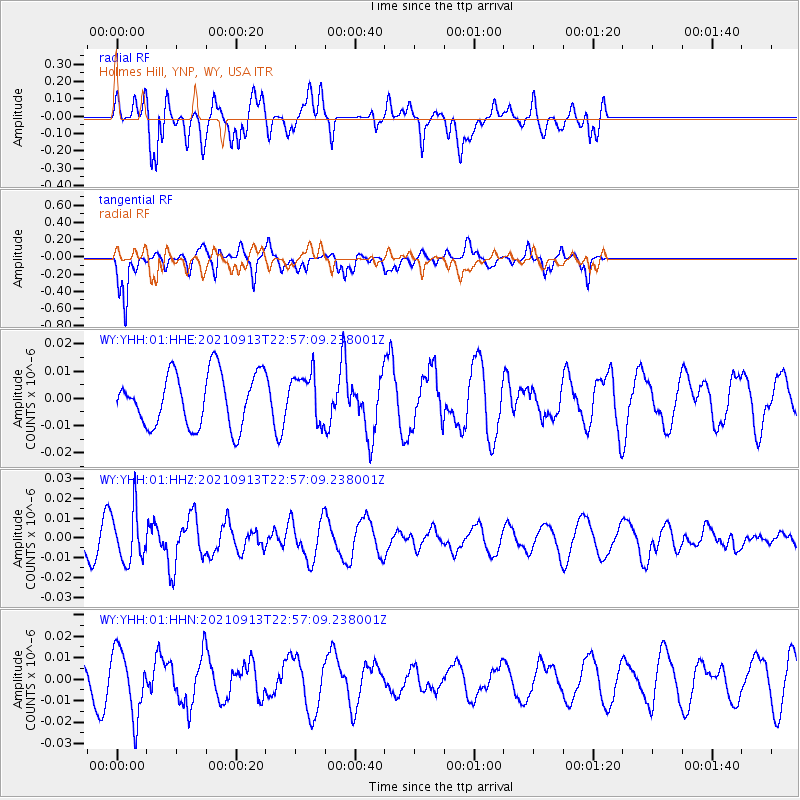
Signal To Noise
| Channel | StoN | STA | LTA |
| WY:YHH:01:HHZ:20210913T22:57:09.238001Z | 1.6856291 | 1.2986736E-8 | 7.704385E-9 |
| WY:YHH:01:HHN:20210913T22:57:09.238001Z | 2.8722057 | 1.5160627E-8 | 5.278391E-9 |
| WY:YHH:01:HHE:20210913T22:57:09.238001Z | 0.9213594 | 8.929306E-9 | 9.691448E-9 |
| Arrivals |
| Ps | |
| PpPs | |
| PsPs/PpSs | |


