You are here: Home > Network List > IW - Intermountain West Stations List
> Station MOOW Moose Ponds, Wyoming, USA > Earthquake Result Viewer
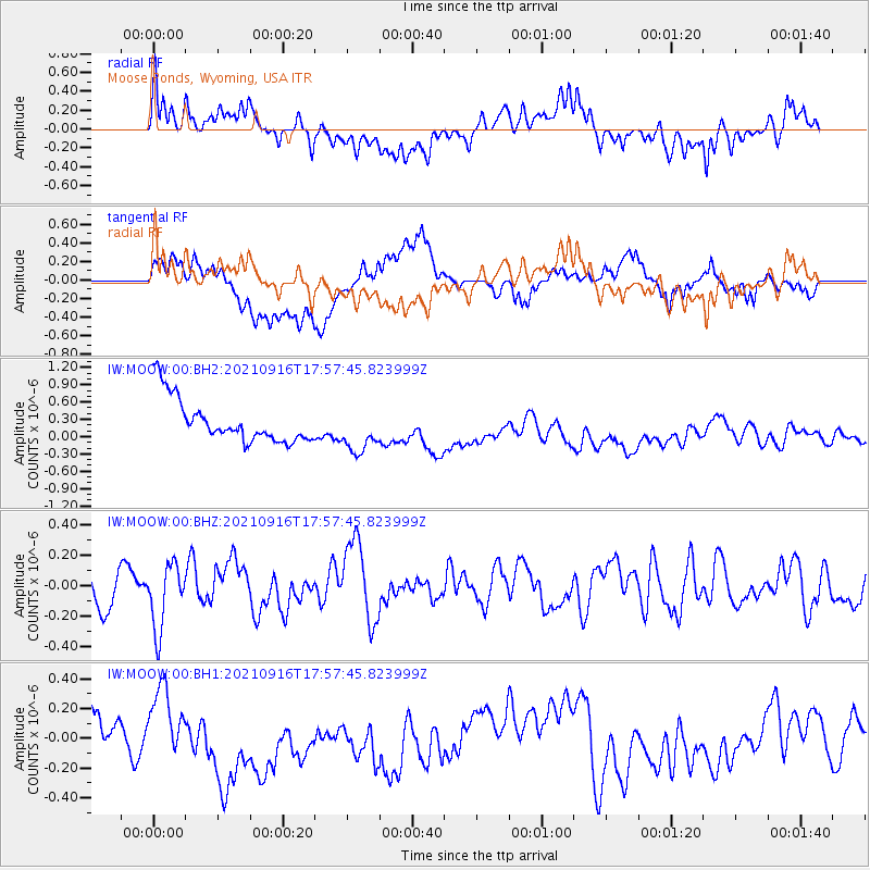
MOOW Moose Ponds, Wyoming, USA - Earthquake Result Viewer
*The percent match for this event was below the threshold and hence no stack was calculated.
| Earthquake location: |
South Of Alaska |
| Earthquake latitude/longitude: |
55.2/-156.7 |
| Earthquake time(UTC): |
2021/09/16 (259) 17:51:54 GMT |
| Earthquake Depth: |
0.0 km |
| Earthquake Magnitude: |
5.6 Mww |
| Earthquake Catalog/Contributor: |
NEIC PDE/ak |
|
| Network: |
IW Intermountain West |
| Station: |
MOOW Moose Ponds, Wyoming, USA |
| Lat/Lon: |
43.75 N/110.74 W |
| Elevation: |
2128 m |
|
| Distance: |
31.4 deg |
| Az: |
92.064 deg |
| Baz: |
307.839 deg |
| Ray Param: |
$rayparam |
*The percent match for this event was below the threshold and hence was not used in the summary stack. |
|
| Radial Match: |
33.145283 % |
| Radial Bump: |
400 |
| Transverse Match: |
46.680584 % |
| Transverse Bump: |
400 |
| SOD ConfigId: |
25131211 |
| Insert Time: |
2021-09-30 18:01:03.217 +0000 |
| GWidth: |
2.5 |
| Max Bumps: |
400 |
| Tol: |
0.001 |
|
Signal To Noise
| Channel | StoN | STA | LTA |
| IW:MOOW:00:BHZ:20210916T17:57:45.823999Z | 1.9816663 | 2.151985E-7 | 1.0859471E-7 |
| IW:MOOW:00:BH1:20210916T17:57:45.823999Z | 0.5494695 | 1.9387494E-7 | 3.5284023E-7 |
| IW:MOOW:00:BH2:20210916T17:57:45.823999Z | 1.0619285 | 3.9912825E-7 | 3.758523E-7 |
| Arrivals |
| Ps | |
| PpPs | |
| PsPs/PpSs | |


