You are here: Home > Network List > WY - Yellowstone Wyoming Seismic Network Stations List
> Station YHH Holmes Hill, YNP, WY, USA > Earthquake Result Viewer
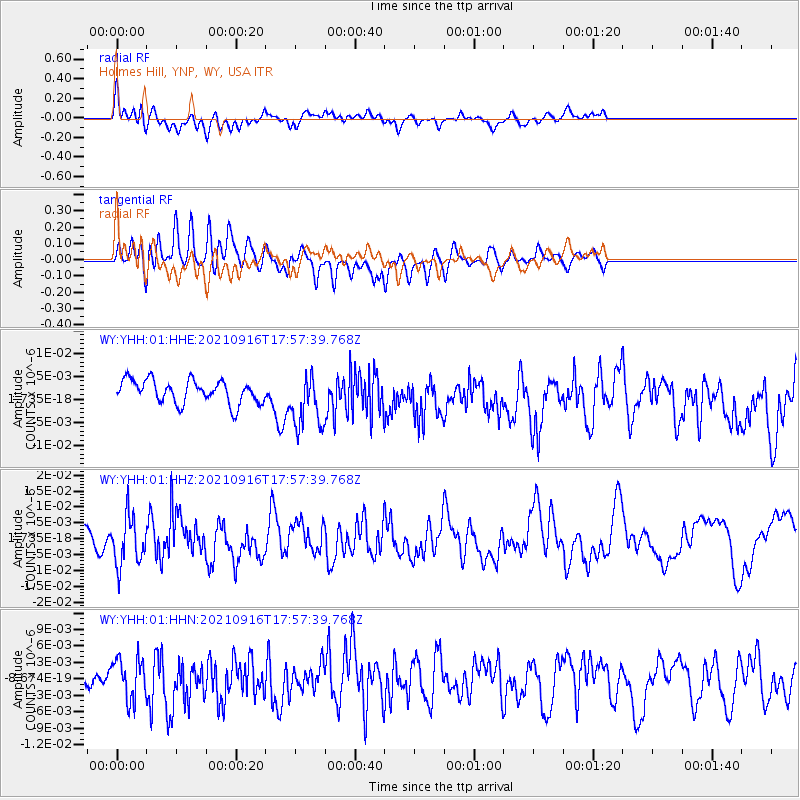
YHH Holmes Hill, YNP, WY, USA - Earthquake Result Viewer
*The percent match for this event was below the threshold and hence no stack was calculated.
| Earthquake location: |
South Of Alaska |
| Earthquake latitude/longitude: |
55.2/-156.7 |
| Earthquake time(UTC): |
2021/09/16 (259) 17:51:54 GMT |
| Earthquake Depth: |
0.0 km |
| Earthquake Magnitude: |
5.6 Mww |
| Earthquake Catalog/Contributor: |
NEIC PDE/ak |
|
| Network: |
WY Yellowstone Wyoming Seismic Network |
| Station: |
YHH Holmes Hill, YNP, WY, USA |
| Lat/Lon: |
44.79 N/110.85 W |
| Elevation: |
2717 m |
|
| Distance: |
30.7 deg |
| Az: |
90.547 deg |
| Baz: |
306.465 deg |
| Ray Param: |
$rayparam |
*The percent match for this event was below the threshold and hence was not used in the summary stack. |
|
| Radial Match: |
55.344982 % |
| Radial Bump: |
400 |
| Transverse Match: |
59.886387 % |
| Transverse Bump: |
400 |
| SOD ConfigId: |
25131211 |
| Insert Time: |
2021-09-30 18:13:23.319 +0000 |
| GWidth: |
2.5 |
| Max Bumps: |
400 |
| Tol: |
0.001 |
|
Signal To Noise
| Channel | StoN | STA | LTA |
| WY:YHH:01:HHZ:20210916T17:57:39.768Z | 3.4039068 | 7.721745E-9 | 2.268495E-9 |
| WY:YHH:01:HHN:20210916T17:57:39.768Z | 1.9353151 | 3.7405385E-9 | 1.9327802E-9 |
| WY:YHH:01:HHE:20210916T17:57:39.768Z | 2.3237631 | 5.866234E-9 | 2.5244544E-9 |
| Arrivals |
| Ps | |
| PpPs | |
| PsPs/PpSs | |


