You are here: Home > Network List > US - United States National Seismic Network Stations List
> Station HAWA Hanford, Washington, USA > Earthquake Result Viewer
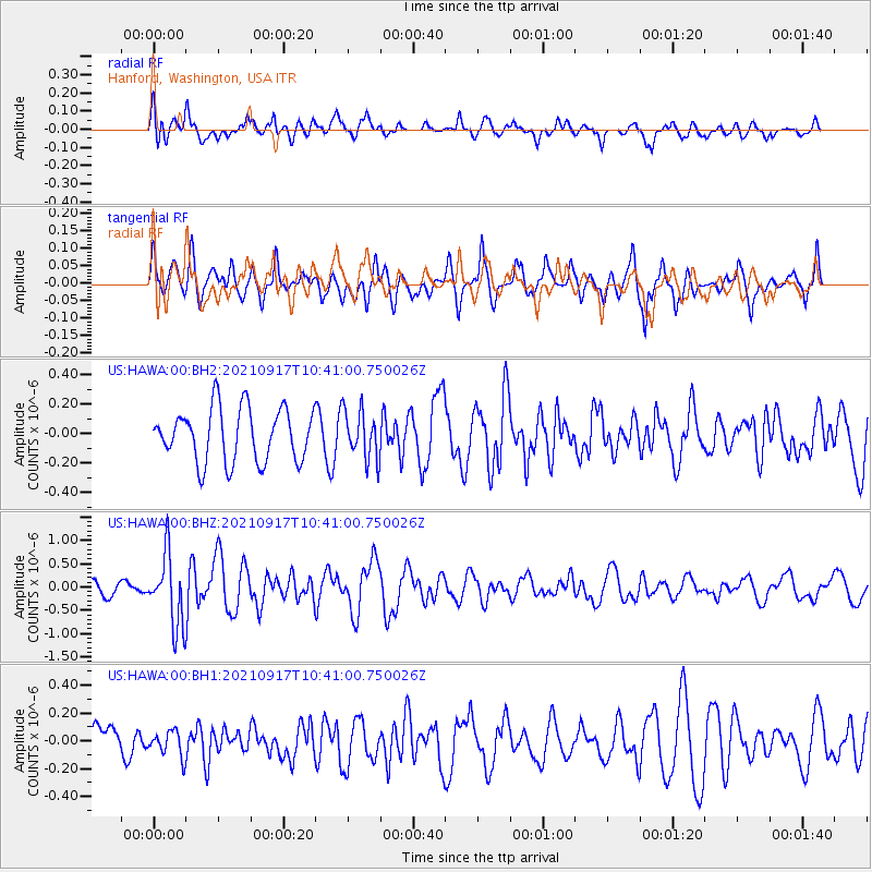
HAWA Hanford, Washington, USA - Earthquake Result Viewer
*The percent match for this event was below the threshold and hence no stack was calculated.
| Earthquake location: |
Vanuatu Islands |
| Earthquake latitude/longitude: |
-13.4/167.4 |
| Earthquake time(UTC): |
2021/09/17 (260) 10:28:40 GMT |
| Earthquake Depth: |
10 km |
| Earthquake Magnitude: |
5.8 mww |
| Earthquake Catalog/Contributor: |
NEIC PDE/us |
|
| Network: |
US United States National Seismic Network |
| Station: |
HAWA Hanford, Washington, USA |
| Lat/Lon: |
46.39 N/119.53 W |
| Elevation: |
364 m |
|
| Distance: |
88.3 deg |
| Az: |
41.483 deg |
| Baz: |
248.62 deg |
| Ray Param: |
$rayparam |
*The percent match for this event was below the threshold and hence was not used in the summary stack. |
|
| Radial Match: |
58.947395 % |
| Radial Bump: |
400 |
| Transverse Match: |
70.69872 % |
| Transverse Bump: |
400 |
| SOD ConfigId: |
25131211 |
| Insert Time: |
2021-10-01 10:45:53.233 +0000 |
| GWidth: |
2.5 |
| Max Bumps: |
400 |
| Tol: |
0.001 |
|
Signal To Noise
| Channel | StoN | STA | LTA |
| US:HAWA:00:BHZ:20210917T10:41:00.750026Z | 5.762289 | 7.636805E-7 | 1.3253074E-7 |
| US:HAWA:00:BH1:20210917T10:41:00.750026Z | 0.8418142 | 9.1337746E-8 | 1.0850107E-7 |
| US:HAWA:00:BH2:20210917T10:41:00.750026Z | 0.91585493 | 1.6487107E-7 | 1.8001876E-7 |
| Arrivals |
| Ps | |
| PpPs | |
| PsPs/PpSs | |


