You are here: Home > Network List > UW - Pacific Northwest Regional Seismic Network Stations List
> Station UMAT Pilot Rock, OR, USA > Earthquake Result Viewer
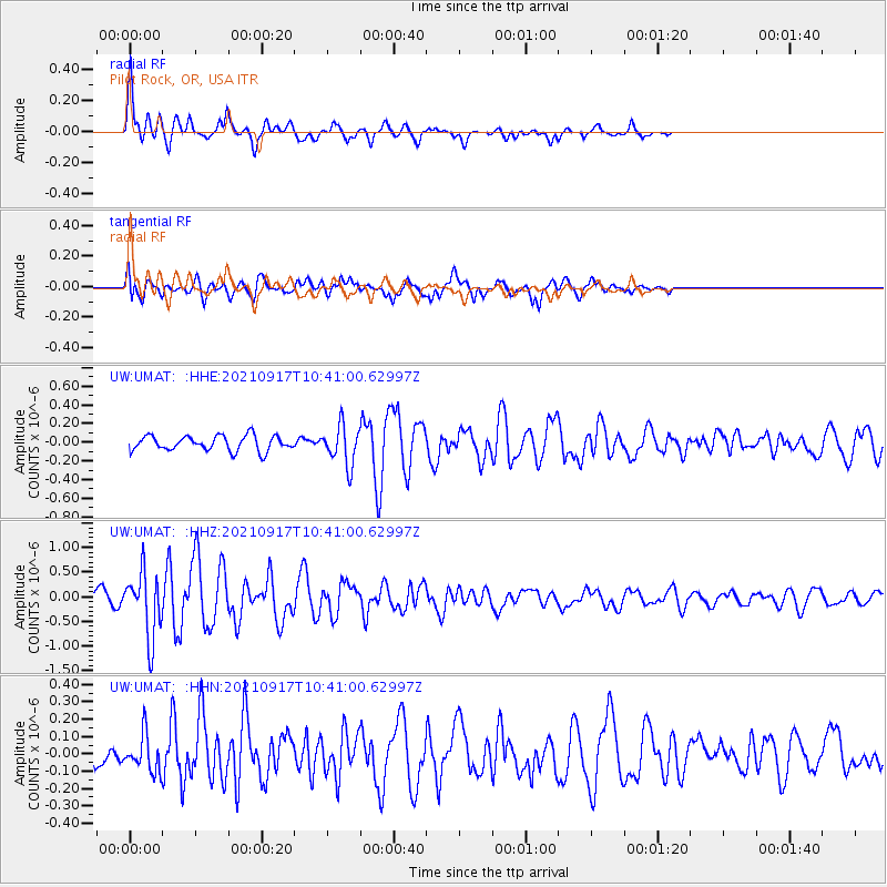
UMAT Pilot Rock, OR, USA - Earthquake Result Viewer
*The percent match for this event was below the threshold and hence no stack was calculated.
| Earthquake location: |
Vanuatu Islands |
| Earthquake latitude/longitude: |
-13.4/167.4 |
| Earthquake time(UTC): |
2021/09/17 (260) 10:28:40 GMT |
| Earthquake Depth: |
10 km |
| Earthquake Magnitude: |
5.8 mww |
| Earthquake Catalog/Contributor: |
NEIC PDE/us |
|
| Network: |
UW Pacific Northwest Regional Seismic Network |
| Station: |
UMAT Pilot Rock, OR, USA |
| Lat/Lon: |
45.29 N/118.96 W |
| Elevation: |
1318 m |
|
| Distance: |
88.3 deg |
| Az: |
42.656 deg |
| Baz: |
249.065 deg |
| Ray Param: |
$rayparam |
*The percent match for this event was below the threshold and hence was not used in the summary stack. |
|
| Radial Match: |
78.75482 % |
| Radial Bump: |
310 |
| Transverse Match: |
69.14553 % |
| Transverse Bump: |
400 |
| SOD ConfigId: |
25131211 |
| Insert Time: |
2021-10-01 10:48:54.306 +0000 |
| GWidth: |
2.5 |
| Max Bumps: |
400 |
| Tol: |
0.001 |
|
Signal To Noise
| Channel | StoN | STA | LTA |
| UW:UMAT: :HHZ:20210917T10:41:00.62997Z | 5.900637 | 6.562199E-7 | 1.11211705E-7 |
| UW:UMAT: :HHN:20210917T10:41:00.62997Z | 1.0320181 | 1.03716395E-7 | 1.00498625E-7 |
| UW:UMAT: :HHE:20210917T10:41:00.62997Z | 2.6025455 | 2.0925208E-7 | 8.0402856E-8 |
| Arrivals |
| Ps | |
| PpPs | |
| PsPs/PpSs | |


