You are here: Home > Network List > CI - Caltech Regional Seismic Network Stations List
> Station MPP McPhearson Peak > Earthquake Result Viewer
MPP McPhearson Peak - Earthquake Result Viewer
*The percent match for this event was below the threshold and hence no stack was calculated.
| Earthquake location: |
Eastern New Guinea Reg., P.N.G. |
| Earthquake latitude/longitude: |
-9.8/148.6 |
| Earthquake time(UTC): |
2021/09/18 (261) 20:47:06 GMT |
| Earthquake Depth: |
15 km |
| Earthquake Magnitude: |
5.3 Mww |
| Earthquake Catalog/Contributor: |
NEIC PDE/us |
|
| Network: |
CI Caltech Regional Seismic Network |
| Station: |
MPP McPhearson Peak |
| Lat/Lon: |
34.89 N/119.81 W |
| Elevation: |
1739 m |
|
| Distance: |
96.8 deg |
| Az: |
55.854 deg |
| Baz: |
262.896 deg |
| Ray Param: |
$rayparam |
*The percent match for this event was below the threshold and hence was not used in the summary stack. |
|
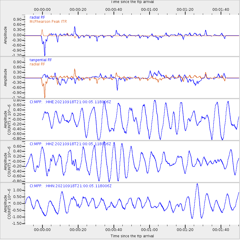
| Radial Match: |
77.41748 % |
| Radial Bump: |
400 |
| Transverse Match: |
40.597847 % |
| Transverse Bump: |
400 |
| SOD ConfigId: |
25131211 |
| Insert Time: |
2021-10-02 20:52:19.049 +0000 |
| GWidth: |
2.5 |
| Max Bumps: |
400 |
| Tol: |
0.001 |
|
Signal To Noise
| Channel | StoN | STA | LTA |
| CI:MPP: :HHZ:20210918T21:00:05.118006Z | 2.3415425 | 3.9219887E-7 | 1.6749594E-7 |
| CI:MPP: :HHN:20210918T21:00:05.118006Z | 2.324232 | 7.1087646E-7 | 3.0585434E-7 |
| CI:MPP: :HHE:20210918T21:00:05.118006Z | 2.3814533 | 5.8885655E-7 | 2.4726774E-7 |
| Arrivals |
| Ps | |
| PpPs | |
| PsPs/PpSs | |


