You are here: Home > Network List > US - United States National Seismic Network Stations List
> Station LKWY Lake (Yellowstone--Lake), Wyoming, USA > Earthquake Result Viewer
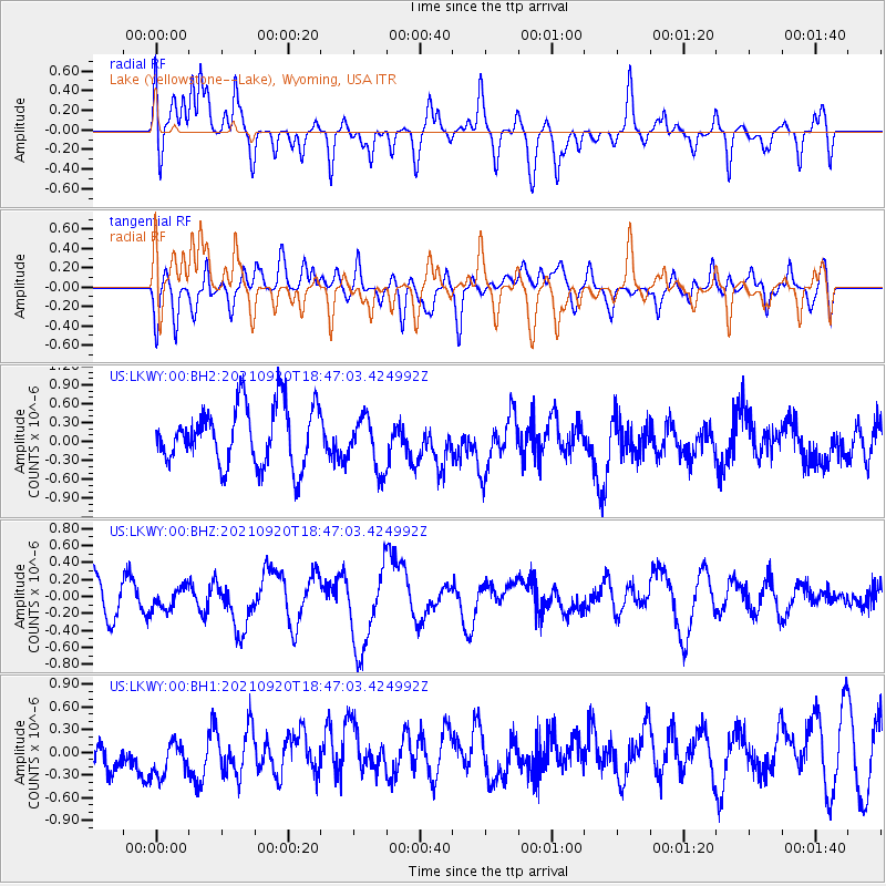
LKWY Lake (Yellowstone--Lake), Wyoming, USA - Earthquake Result Viewer
*The percent match for this event was below the threshold and hence no stack was calculated.
| Earthquake location: |
Tonga Islands |
| Earthquake latitude/longitude: |
-21.1/-173.8 |
| Earthquake time(UTC): |
2021/09/20 (263) 18:34:48 GMT |
| Earthquake Depth: |
10 km |
| Earthquake Magnitude: |
5.8 Mww |
| Earthquake Catalog/Contributor: |
NEIC PDE/us |
|
| Network: |
US United States National Seismic Network |
| Station: |
LKWY Lake (Yellowstone--Lake), Wyoming, USA |
| Lat/Lon: |
44.57 N/110.40 W |
| Elevation: |
2424 m |
|
| Distance: |
87.2 deg |
| Az: |
39.776 deg |
| Baz: |
236.704 deg |
| Ray Param: |
$rayparam |
*The percent match for this event was below the threshold and hence was not used in the summary stack. |
|
| Radial Match: |
58.222374 % |
| Radial Bump: |
400 |
| Transverse Match: |
46.08649 % |
| Transverse Bump: |
400 |
| SOD ConfigId: |
25131211 |
| Insert Time: |
2021-10-04 18:51:06.426 +0000 |
| GWidth: |
2.5 |
| Max Bumps: |
400 |
| Tol: |
0.001 |
|
Signal To Noise
| Channel | StoN | STA | LTA |
| US:LKWY:00:BHZ:20210920T18:47:03.424992Z | 0.92506844 | 1.4883653E-7 | 1.6089245E-7 |
| US:LKWY:00:BH1:20210920T18:47:03.424992Z | 1.024898 | 4.0127586E-7 | 3.9152758E-7 |
| US:LKWY:00:BH2:20210920T18:47:03.424992Z | 0.88592243 | 4.1537953E-7 | 4.6886672E-7 |
| Arrivals |
| Ps | |
| PpPs | |
| PsPs/PpSs | |


