You are here: Home > Network List > CI - Caltech Regional Seismic Network Stations List
> Station BAR Barrett, Tecate, CA, USA > Earthquake Result Viewer
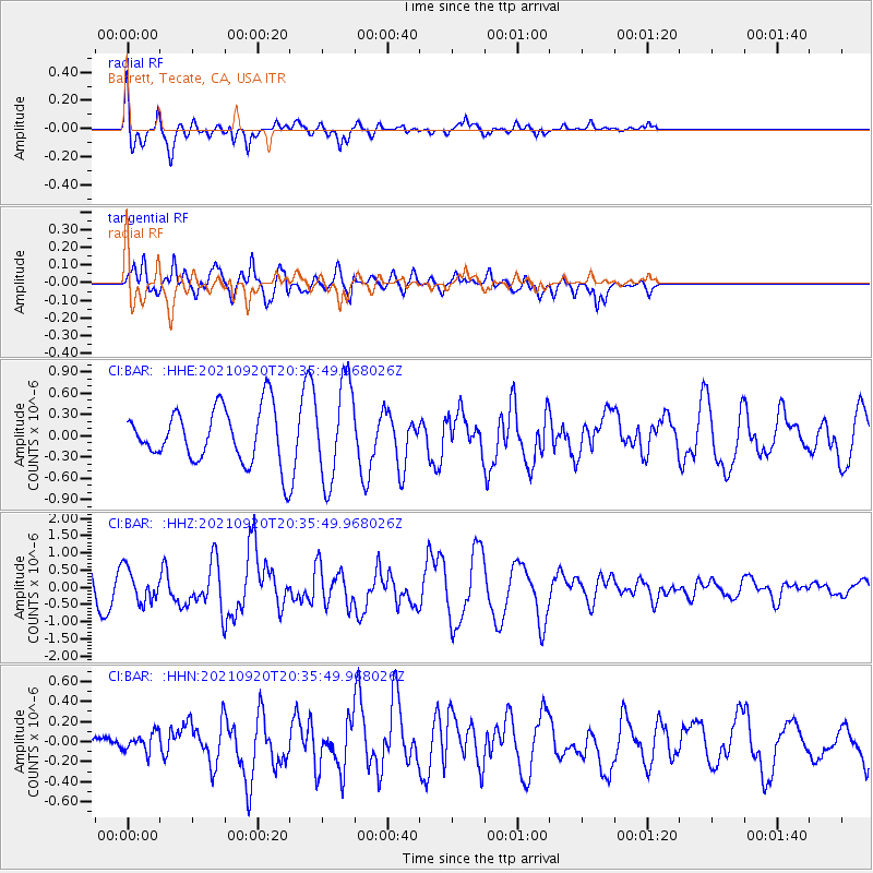
BAR Barrett, Tecate, CA, USA - Earthquake Result Viewer
*The percent match for this event was below the threshold and hence no stack was calculated.
| Earthquake location: |
Kuril Islands |
| Earthquake latitude/longitude: |
46.4/152.4 |
| Earthquake time(UTC): |
2021/09/20 (263) 20:25:25 GMT |
| Earthquake Depth: |
25 km |
| Earthquake Magnitude: |
6.0 mww |
| Earthquake Catalog/Contributor: |
NEIC PDE/us |
|
| Network: |
CI Caltech Regional Seismic Network |
| Station: |
BAR Barrett, Tecate, CA, USA |
| Lat/Lon: |
32.68 N/116.67 W |
| Elevation: |
521 m |
|
| Distance: |
67.8 deg |
| Az: |
65.652 deg |
| Baz: |
311.623 deg |
| Ray Param: |
$rayparam |
*The percent match for this event was below the threshold and hence was not used in the summary stack. |
|
| Radial Match: |
64.41972 % |
| Radial Bump: |
356 |
| Transverse Match: |
73.81992 % |
| Transverse Bump: |
400 |
| SOD ConfigId: |
25131211 |
| Insert Time: |
2021-10-04 20:33:03.368 +0000 |
| GWidth: |
2.5 |
| Max Bumps: |
400 |
| Tol: |
0.001 |
|
Signal To Noise
| Channel | StoN | STA | LTA |
| CI:BAR: :HHZ:20210920T20:35:49.968026Z | 1.3577747 | 4.7966427E-7 | 3.5327233E-7 |
| CI:BAR: :HHN:20210920T20:35:49.968026Z | 0.7677425 | 9.317989E-8 | 1.2136867E-7 |
| CI:BAR: :HHE:20210920T20:35:49.968026Z | 1.8290331 | 6.878208E-7 | 3.7605705E-7 |
| Arrivals |
| Ps | |
| PpPs | |
| PsPs/PpSs | |


