You are here: Home > Network List > US - United States National Seismic Network Stations List
> Station AMTX Amarillo, Texas, USA > Earthquake Result Viewer
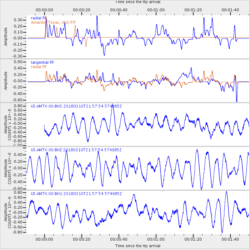
AMTX Amarillo, Texas, USA - Earthquake Result Viewer
*The percent match for this event was below the threshold and hence no stack was calculated.
| Earthquake location: |
North Of Ascension Island |
| Earthquake latitude/longitude: |
-1.4/-15.2 |
| Earthquake time(UTC): |
2018/03/10 (069) 21:45:36 GMT |
| Earthquake Depth: |
10 km |
| Earthquake Magnitude: |
5.9 Mww |
| Earthquake Catalog/Contributor: |
NEIC PDE/us |
|
| Network: |
US United States National Seismic Network |
| Station: |
AMTX Amarillo, Texas, USA |
| Lat/Lon: |
34.53 N/101.41 W |
| Elevation: |
1010 m |
|
| Distance: |
87.7 deg |
| Az: |
304.465 deg |
| Baz: |
93.308 deg |
| Ray Param: |
$rayparam |
*The percent match for this event was below the threshold and hence was not used in the summary stack. |
|
| Radial Match: |
38.21065 % |
| Radial Bump: |
400 |
| Transverse Match: |
39.856544 % |
| Transverse Bump: |
400 |
| SOD ConfigId: |
2615551 |
| Insert Time: |
2018-03-24 21:49:33.433 +0000 |
| GWidth: |
2.5 |
| Max Bumps: |
400 |
| Tol: |
0.001 |
|
Signal To Noise
| Channel | StoN | STA | LTA |
| US:AMTX:00:BHZ:20180310T21:57:54.574985Z | 1.6661478 | 3.6447E-7 | 2.187501E-7 |
| US:AMTX:00:BH1:20180310T21:57:54.574985Z | 0.70060456 | 2.5014606E-7 | 3.5704315E-7 |
| US:AMTX:00:BH2:20180310T21:57:54.574985Z | 0.85506034 | 2.594155E-7 | 3.033885E-7 |
| Arrivals |
| Ps | |
| PpPs | |
| PsPs/PpSs | |


