You are here: Home > Network List > GS - US Geological Survey Networks Stations List
> Station DEC06 Boomer > Earthquake Result Viewer
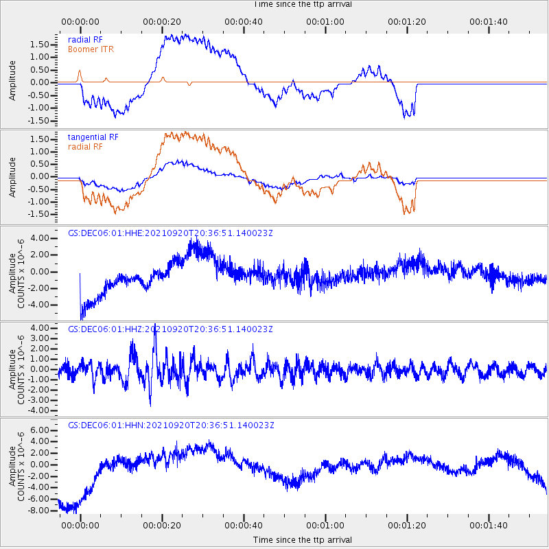
DEC06 Boomer - Earthquake Result Viewer
*The percent match for this event was below the threshold and hence no stack was calculated.
| Earthquake location: |
Kuril Islands |
| Earthquake latitude/longitude: |
46.4/152.4 |
| Earthquake time(UTC): |
2021/09/20 (263) 20:25:25 GMT |
| Earthquake Depth: |
25 km |
| Earthquake Magnitude: |
6.0 mww |
| Earthquake Catalog/Contributor: |
NEIC PDE/us |
|
| Network: |
GS US Geological Survey Networks |
| Station: |
DEC06 Boomer |
| Lat/Lon: |
39.90 N/88.95 W |
| Elevation: |
215 m |
|
| Distance: |
78.1 deg |
| Az: |
43.628 deg |
| Baz: |
321.639 deg |
| Ray Param: |
$rayparam |
*The percent match for this event was below the threshold and hence was not used in the summary stack. |
|
| Radial Match: |
33.131058 % |
| Radial Bump: |
400 |
| Transverse Match: |
31.273539 % |
| Transverse Bump: |
400 |
| SOD ConfigId: |
25131211 |
| Insert Time: |
2021-10-04 20:37:13.053 +0000 |
| GWidth: |
2.5 |
| Max Bumps: |
400 |
| Tol: |
0.001 |
|
Signal To Noise
| Channel | StoN | STA | LTA |
| GS:DEC06:01:HHZ:20210920T20:36:51.140023Z | 2.1098676 | 7.3349065E-7 | 3.476477E-7 |
| GS:DEC06:01:HHN:20210920T20:36:51.140023Z | 1.8244804 | 6.409769E-6 | 3.5132023E-6 |
| GS:DEC06:01:HHE:20210920T20:36:51.140023Z | 1.9509542 | 3.341926E-6 | 1.7129701E-6 |
| Arrivals |
| Ps | |
| PpPs | |
| PsPs/PpSs | |


