You are here: Home > Network List > GS - US Geological Survey Networks Stations List
> Station OK051 E0350 and S34600 roads, Ralston OK > Earthquake Result Viewer
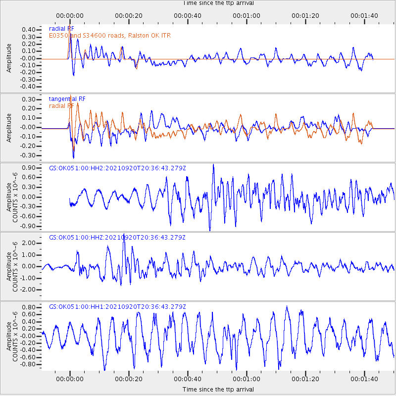
OK051 E0350 and S34600 roads, Ralston OK - Earthquake Result Viewer
*The percent match for this event was below the threshold and hence no stack was calculated.
| Earthquake location: |
Kuril Islands |
| Earthquake latitude/longitude: |
46.4/152.4 |
| Earthquake time(UTC): |
2021/09/20 (263) 20:25:25 GMT |
| Earthquake Depth: |
25 km |
| Earthquake Magnitude: |
6.0 mww |
| Earthquake Catalog/Contributor: |
NEIC PDE/us |
|
| Network: |
GS US Geological Survey Networks |
| Station: |
OK051 E0350 and S34600 roads, Ralston OK |
| Lat/Lon: |
36.50 N/96.84 W |
| Elevation: |
263 m |
|
| Distance: |
76.7 deg |
| Az: |
50.732 deg |
| Baz: |
318.325 deg |
| Ray Param: |
$rayparam |
*The percent match for this event was below the threshold and hence was not used in the summary stack. |
|
| Radial Match: |
61.326626 % |
| Radial Bump: |
400 |
| Transverse Match: |
79.682846 % |
| Transverse Bump: |
400 |
| SOD ConfigId: |
25131211 |
| Insert Time: |
2021-10-04 20:37:18.251 +0000 |
| GWidth: |
2.5 |
| Max Bumps: |
400 |
| Tol: |
0.001 |
|
Signal To Noise
| Channel | StoN | STA | LTA |
| GS:OK051:00:HHZ:20210920T20:36:43.279Z | 3.2376766 | 5.237841E-7 | 1.6177776E-7 |
| GS:OK051:00:HH1:20210920T20:36:43.279Z | 1.6219008 | 2.341615E-7 | 1.4437474E-7 |
| GS:OK051:00:HH2:20210920T20:36:43.279Z | 2.0106344 | 3.478638E-7 | 1.7301194E-7 |
| Arrivals |
| Ps | |
| PpPs | |
| PsPs/PpSs | |


