You are here: Home > Network List > HV - Hawaiian Volcano Observatory Network Stations List
> Station MLOD Mauna Loa, Hawaii Digital > Earthquake Result Viewer
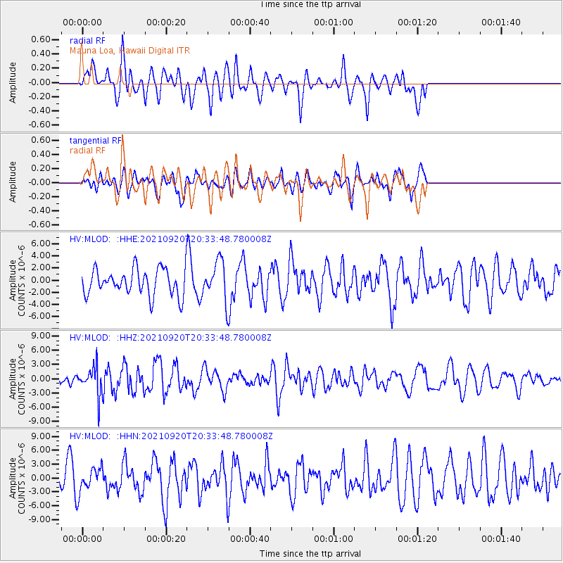
MLOD Mauna Loa, Hawaii Digital - Earthquake Result Viewer
*The percent match for this event was below the threshold and hence no stack was calculated.
| Earthquake location: |
Kuril Islands |
| Earthquake latitude/longitude: |
46.4/152.4 |
| Earthquake time(UTC): |
2021/09/20 (263) 20:25:25 GMT |
| Earthquake Depth: |
25 km |
| Earthquake Magnitude: |
6.0 mww |
| Earthquake Catalog/Contributor: |
NEIC PDE/us |
|
| Network: |
HV Hawaiian Volcano Observatory Network |
| Station: |
MLOD Mauna Loa, Hawaii Digital |
| Lat/Lon: |
19.49 N/155.39 W |
| Elevation: |
2044 m |
|
| Distance: |
50.2 deg |
| Az: |
104.145 deg |
| Baz: |
314.663 deg |
| Ray Param: |
$rayparam |
*The percent match for this event was below the threshold and hence was not used in the summary stack. |
|
| Radial Match: |
56.89756 % |
| Radial Bump: |
400 |
| Transverse Match: |
46.34223 % |
| Transverse Bump: |
400 |
| SOD ConfigId: |
25131211 |
| Insert Time: |
2021-10-04 20:37:48.446 +0000 |
| GWidth: |
2.5 |
| Max Bumps: |
400 |
| Tol: |
0.001 |
|
Signal To Noise
| Channel | StoN | STA | LTA |
| HV:MLOD: :HHZ:20210920T20:33:48.780008Z | 1.7968962 | 2.9850635E-6 | 1.661233E-6 |
| HV:MLOD: :HHN:20210920T20:33:48.780008Z | 0.7484674 | 2.4299525E-6 | 3.246571E-6 |
| HV:MLOD: :HHE:20210920T20:33:48.780008Z | 1.5319512 | 3.2771154E-6 | 2.1391775E-6 |
| Arrivals |
| Ps | |
| PpPs | |
| PsPs/PpSs | |


