You are here: Home > Network List > US - United States National Seismic Network Stations List
> Station AMTX Amarillo, Texas, USA > Earthquake Result Viewer
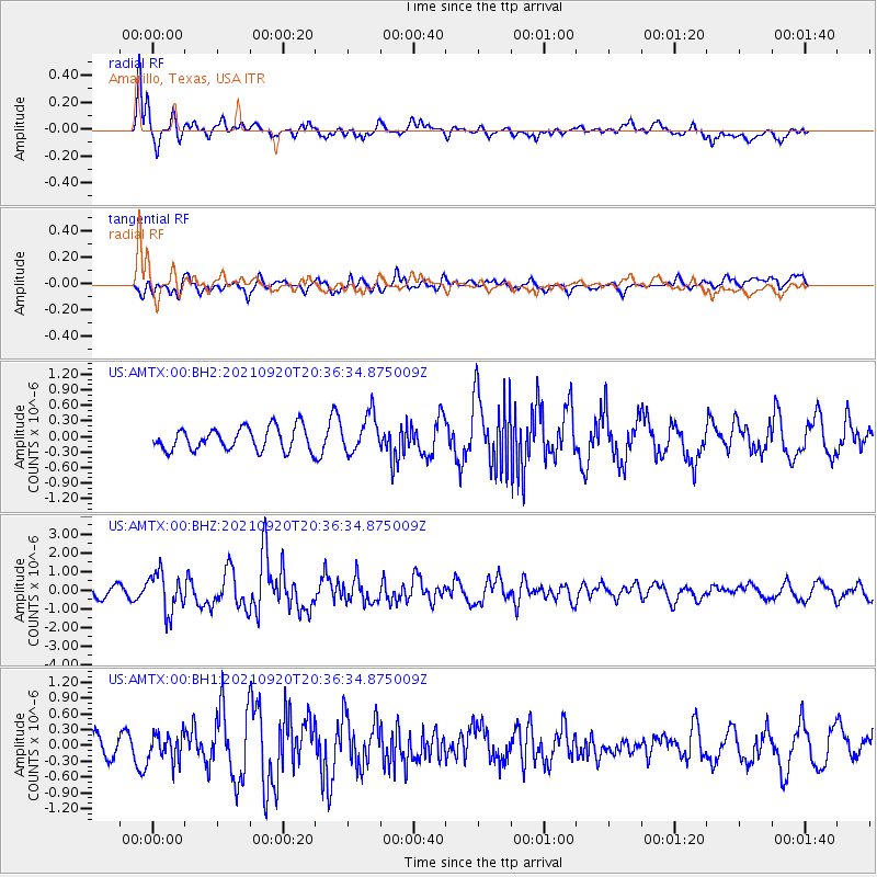
AMTX Amarillo, Texas, USA - Earthquake Result Viewer
*The percent match for this event was below the threshold and hence no stack was calculated.
| Earthquake location: |
Kuril Islands |
| Earthquake latitude/longitude: |
46.4/152.4 |
| Earthquake time(UTC): |
2021/09/20 (263) 20:25:25 GMT |
| Earthquake Depth: |
25 km |
| Earthquake Magnitude: |
6.0 mww |
| Earthquake Catalog/Contributor: |
NEIC PDE/us |
|
| Network: |
US United States National Seismic Network |
| Station: |
AMTX Amarillo, Texas, USA |
| Lat/Lon: |
34.53 N/101.41 W |
| Elevation: |
1010 m |
|
| Distance: |
75.6 deg |
| Az: |
54.935 deg |
| Baz: |
316.684 deg |
| Ray Param: |
$rayparam |
*The percent match for this event was below the threshold and hence was not used in the summary stack. |
|
| Radial Match: |
68.65207 % |
| Radial Bump: |
400 |
| Transverse Match: |
65.01432 % |
| Transverse Bump: |
400 |
| SOD ConfigId: |
25131211 |
| Insert Time: |
2021-10-04 20:49:25.975 +0000 |
| GWidth: |
2.5 |
| Max Bumps: |
400 |
| Tol: |
0.001 |
|
Signal To Noise
| Channel | StoN | STA | LTA |
| US:AMTX:00:BHZ:20210920T20:36:34.875009Z | 4.8118405 | 1.0490576E-6 | 2.1801586E-7 |
| US:AMTX:00:BH1:20210920T20:36:34.875009Z | 1.1884874 | 2.5824318E-7 | 2.1728727E-7 |
| US:AMTX:00:BH2:20210920T20:36:34.875009Z | 1.6766948 | 3.9377417E-7 | 2.3485143E-7 |
| Arrivals |
| Ps | |
| PpPs | |
| PsPs/PpSs | |


