You are here: Home > Network List > US - United States National Seismic Network Stations List
> Station DUG Dugway, Tooele County, Utah, USA > Earthquake Result Viewer
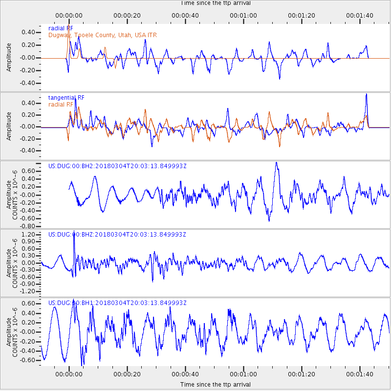
DUG Dugway, Tooele County, Utah, USA - Earthquake Result Viewer
*The percent match for this event was below the threshold and hence no stack was calculated.
| Earthquake location: |
Kuril Islands |
| Earthquake latitude/longitude: |
45.1/147.8 |
| Earthquake time(UTC): |
2018/03/04 (063) 19:52:52 GMT |
| Earthquake Depth: |
104 km |
| Earthquake Magnitude: |
5.4 Mww |
| Earthquake Catalog/Contributor: |
NEIC PDE/us |
|
| Network: |
US United States National Seismic Network |
| Station: |
DUG Dugway, Tooele County, Utah, USA |
| Lat/Lon: |
40.19 N/112.81 W |
| Elevation: |
1477 m |
|
| Distance: |
68.6 deg |
| Az: |
54.259 deg |
| Baz: |
311.318 deg |
| Ray Param: |
$rayparam |
*The percent match for this event was below the threshold and hence was not used in the summary stack. |
|
| Radial Match: |
60.248672 % |
| Radial Bump: |
400 |
| Transverse Match: |
42.209652 % |
| Transverse Bump: |
400 |
| SOD ConfigId: |
2615551 |
| Insert Time: |
2018-04-02 13:35:44.123 +0000 |
| GWidth: |
2.5 |
| Max Bumps: |
400 |
| Tol: |
0.001 |
|
Signal To Noise
| Channel | StoN | STA | LTA |
| US:DUG:00:BHZ:20180304T20:03:13.849993Z | 3.4595888 | 3.9461233E-7 | 1.1406337E-7 |
| US:DUG:00:BH1:20180304T20:03:13.849993Z | 1.615925 | 4.0908412E-7 | 2.5315788E-7 |
| US:DUG:00:BH2:20180304T20:03:13.849993Z | 0.6924416 | 1.4113643E-7 | 2.038243E-7 |
| Arrivals |
| Ps | |
| PpPs | |
| PsPs/PpSs | |


