You are here: Home > Network List > US - United States National Seismic Network Stations List
> Station EGMT Eagleton, Montana, USA > Earthquake Result Viewer
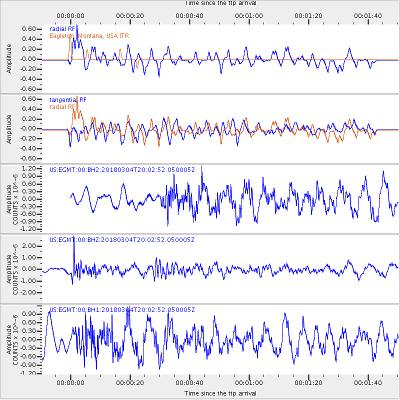
EGMT Eagleton, Montana, USA - Earthquake Result Viewer
*The percent match for this event was below the threshold and hence no stack was calculated.
| Earthquake location: |
Kuril Islands |
| Earthquake latitude/longitude: |
45.1/147.8 |
| Earthquake time(UTC): |
2018/03/04 (063) 19:52:52 GMT |
| Earthquake Depth: |
104 km |
| Earthquake Magnitude: |
5.4 Mww |
| Earthquake Catalog/Contributor: |
NEIC PDE/us |
|
| Network: |
US United States National Seismic Network |
| Station: |
EGMT Eagleton, Montana, USA |
| Lat/Lon: |
48.02 N/109.75 W |
| Elevation: |
1055 m |
|
| Distance: |
65.2 deg |
| Az: |
46.252 deg |
| Baz: |
310.294 deg |
| Ray Param: |
$rayparam |
*The percent match for this event was below the threshold and hence was not used in the summary stack. |
|
| Radial Match: |
54.637413 % |
| Radial Bump: |
379 |
| Transverse Match: |
49.550503 % |
| Transverse Bump: |
400 |
| SOD ConfigId: |
2615551 |
| Insert Time: |
2018-04-02 13:35:47.105 +0000 |
| GWidth: |
2.5 |
| Max Bumps: |
400 |
| Tol: |
0.001 |
|
Signal To Noise
| Channel | StoN | STA | LTA |
| US:EGMT:00:BHZ:20180304T20:02:52.050005Z | 4.5938897 | 7.1180835E-7 | 1.5494676E-7 |
| US:EGMT:00:BH1:20180304T20:02:52.050005Z | 0.9144149 | 3.3855366E-7 | 3.7024077E-7 |
| US:EGMT:00:BH2:20180304T20:02:52.050005Z | 1.3711587 | 3.5161906E-7 | 2.5643934E-7 |
| Arrivals |
| Ps | |
| PpPs | |
| PsPs/PpSs | |


