You are here: Home > Network List > UW - Pacific Northwest Regional Seismic Network Stations List
> Station DAVN Davenport, WA, USA > Earthquake Result Viewer
DAVN Davenport, WA, USA - Earthquake Result Viewer

| Earthquake location: |
Near Coast Of Nicaragua |
| Earthquake latitude/longitude: |
12.1/-87.8 |
| Earthquake time(UTC): |
2021/09/22 (265) 09:57:07 GMT |
| Earthquake Depth: |
10 km |
| Earthquake Magnitude: |
6.7 Mi |
| Earthquake Catalog/Contributor: |
NEIC PDE/at |
|
| Network: |
UW Pacific Northwest Regional Seismic Network |
| Station: |
DAVN Davenport, WA, USA |
| Lat/Lon: |
47.80 N/118.27 W |
| Elevation: |
483 m |
|
| Distance: |
43.8 deg |
| Az: |
330.378 deg |
| Baz: |
134.188 deg |
| Ray Param: |
0.072339594 |
| Estimated Moho Depth: |
30.5 km |
| Estimated Crust Vp/Vs: |
1.67 |
| Assumed Crust Vp: |
6.419 km/s |
| Estimated Crust Vs: |
3.844 km/s |
| Estimated Crust Poisson's Ratio: |
0.22 |
|
| Radial Match: |
92.30761 % |
| Radial Bump: |
382 |
| Transverse Match: |
60.99941 % |
| Transverse Bump: |
400 |
| SOD ConfigId: |
25131211 |
| Insert Time: |
2021-10-06 10:25:48.989 +0000 |
| GWidth: |
2.5 |
| Max Bumps: |
400 |
| Tol: |
0.001 |
|
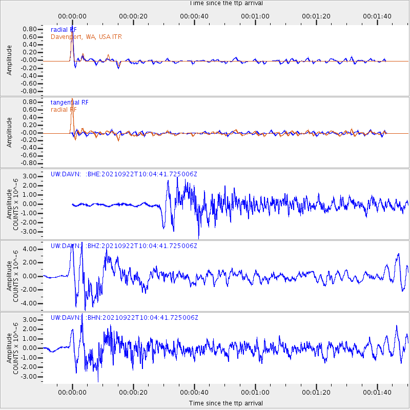
Signal To Noise
| Channel | StoN | STA | LTA |
| UW:DAVN: :BHZ:20210922T10:04:41.725006Z | 30.46866 | 3.0103317E-6 | 9.8800925E-8 |
| UW:DAVN: :BHN:20210922T10:04:41.725006Z | 15.053883 | 1.5274064E-6 | 1.01462625E-7 |
| UW:DAVN: :BHE:20210922T10:04:41.725006Z | 16.59478 | 1.6991863E-6 | 1.02392825E-7 |
| Arrivals |
| Ps | 3.4 SECOND |
| PpPs | 12 SECOND |
| PsPs/PpSs | 15 SECOND |


