You are here: Home > Network List > IW - Intermountain West Stations List
> Station MOOW Moose Ponds, Wyoming, USA > Earthquake Result Viewer
MOOW Moose Ponds, Wyoming, USA - Earthquake Result Viewer
*The percent match for this event was below the threshold and hence no stack was calculated.
| Earthquake location: |
Near Coast Of Nicaragua |
| Earthquake latitude/longitude: |
12.1/-87.7 |
| Earthquake time(UTC): |
2021/09/22 (265) 12:57:00 GMT |
| Earthquake Depth: |
33 km |
| Earthquake Magnitude: |
5.6 mww |
| Earthquake Catalog/Contributor: |
NEIC PDE/us |
|
| Network: |
IW Intermountain West |
| Station: |
MOOW Moose Ponds, Wyoming, USA |
| Lat/Lon: |
43.75 N/110.74 W |
| Elevation: |
2128 m |
|
| Distance: |
37.3 deg |
| Az: |
332.065 deg |
| Baz: |
140.778 deg |
| Ray Param: |
$rayparam |
*The percent match for this event was below the threshold and hence was not used in the summary stack. |
|
| Radial Match: |
73.91301 % |
| Radial Bump: |
400 |
| Transverse Match: |
68.377914 % |
| Transverse Bump: |
400 |
| SOD ConfigId: |
25131211 |
| Insert Time: |
2021-10-06 13:09:10.285 +0000 |
| GWidth: |
2.5 |
| Max Bumps: |
400 |
| Tol: |
0.001 |
|
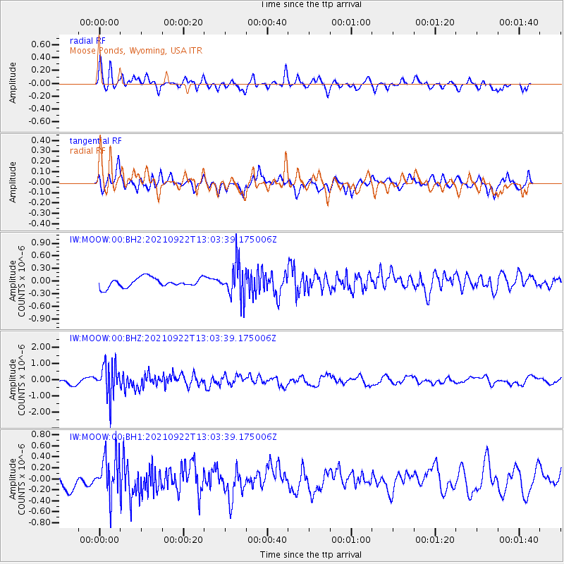
Signal To Noise
| Channel | StoN | STA | LTA |
| IW:MOOW:00:BHZ:20210922T13:03:39.175006Z | 6.211144 | 9.771447E-7 | 1.5732121E-7 |
| IW:MOOW:00:BH1:20210922T13:03:39.175006Z | 2.9151483 | 3.8049987E-7 | 1.3052505E-7 |
| IW:MOOW:00:BH2:20210922T13:03:39.175006Z | 3.7336066 | 4.1907782E-7 | 1.1224477E-7 |
| Arrivals |
| Ps | |
| PpPs | |
| PsPs/PpSs | |


