You are here: Home > Network List > NE - New England Seismic Network Stations List
> Station EMMW Machias, ME, USA > Earthquake Result Viewer
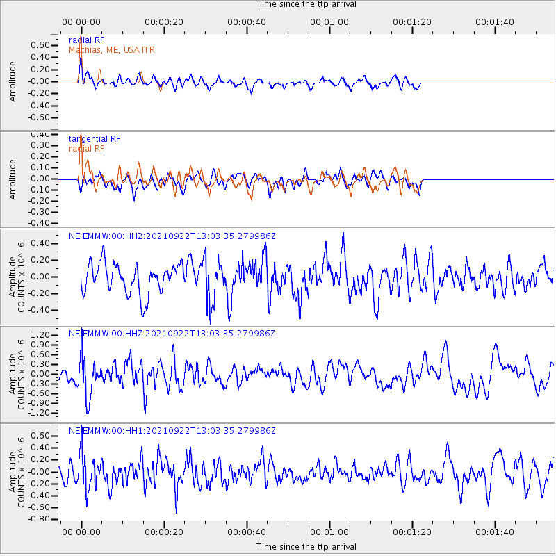
EMMW Machias, ME, USA - Earthquake Result Viewer
*The percent match for this event was below the threshold and hence no stack was calculated.
| Earthquake location: |
Near Coast Of Nicaragua |
| Earthquake latitude/longitude: |
12.1/-87.7 |
| Earthquake time(UTC): |
2021/09/22 (265) 12:57:00 GMT |
| Earthquake Depth: |
33 km |
| Earthquake Magnitude: |
5.6 mww |
| Earthquake Catalog/Contributor: |
NEIC PDE/us |
|
| Network: |
NE New England Seismic Network |
| Station: |
EMMW Machias, ME, USA |
| Lat/Lon: |
44.71 N/67.46 W |
| Elevation: |
35 m |
|
| Distance: |
36.9 deg |
| Az: |
24.264 deg |
| Baz: |
214.314 deg |
| Ray Param: |
$rayparam |
*The percent match for this event was below the threshold and hence was not used in the summary stack. |
|
| Radial Match: |
62.303463 % |
| Radial Bump: |
400 |
| Transverse Match: |
66.274216 % |
| Transverse Bump: |
400 |
| SOD ConfigId: |
25131211 |
| Insert Time: |
2021-10-06 13:10:48.933 +0000 |
| GWidth: |
2.5 |
| Max Bumps: |
400 |
| Tol: |
0.001 |
|
Signal To Noise
| Channel | StoN | STA | LTA |
| NE:EMMW:00:HHZ:20210922T13:03:35.279986Z | 2.8341618 | 6.080826E-7 | 2.1455465E-7 |
| NE:EMMW:00:HH1:20210922T13:03:35.279986Z | 1.9247525 | 2.9187856E-7 | 1.5164473E-7 |
| NE:EMMW:00:HH2:20210922T13:03:35.279986Z | 1.4359168 | 2.5279522E-7 | 1.7605144E-7 |
| Arrivals |
| Ps | |
| PpPs | |
| PsPs/PpSs | |


