You are here: Home > Network List > US - United States National Seismic Network Stations List
> Station HAWA Hanford, Washington, USA > Earthquake Result Viewer
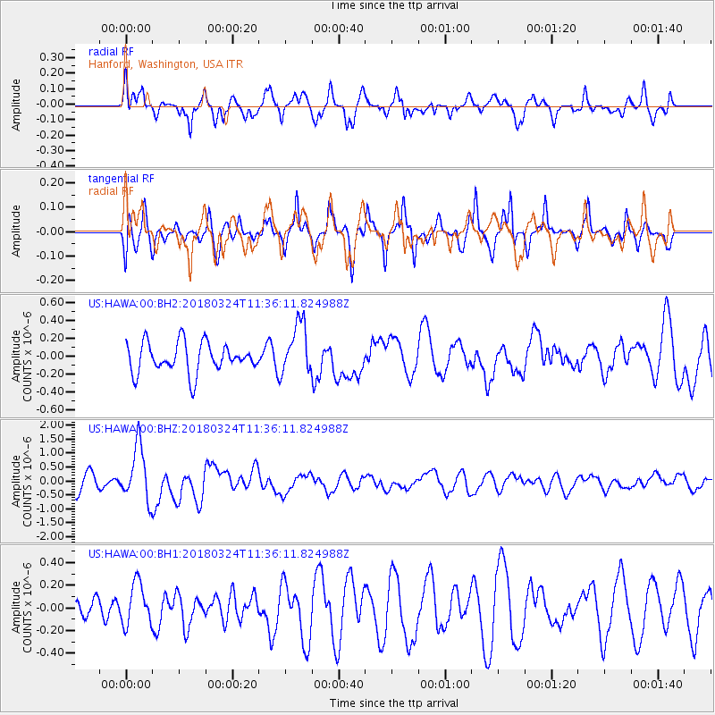
HAWA Hanford, Washington, USA - Earthquake Result Viewer
*The percent match for this event was below the threshold and hence no stack was calculated.
| Earthquake location: |
New Britain Region, P.N.G. |
| Earthquake latitude/longitude: |
-5.5/151.5 |
| Earthquake time(UTC): |
2018/03/24 (083) 11:23:32 GMT |
| Earthquake Depth: |
36 km |
| Earthquake Magnitude: |
6.3 mww |
| Earthquake Catalog/Contributor: |
NEIC PDE/us |
|
| Network: |
US United States National Seismic Network |
| Station: |
HAWA Hanford, Washington, USA |
| Lat/Lon: |
46.39 N/119.53 W |
| Elevation: |
364 m |
|
| Distance: |
93.2 deg |
| Az: |
43.878 deg |
| Baz: |
265.496 deg |
| Ray Param: |
$rayparam |
*The percent match for this event was below the threshold and hence was not used in the summary stack. |
|
| Radial Match: |
70.89351 % |
| Radial Bump: |
400 |
| Transverse Match: |
71.439644 % |
| Transverse Bump: |
400 |
| SOD ConfigId: |
2615551 |
| Insert Time: |
2018-04-07 11:26:51.612 +0000 |
| GWidth: |
2.5 |
| Max Bumps: |
400 |
| Tol: |
0.001 |
|
Signal To Noise
| Channel | StoN | STA | LTA |
| US:HAWA:00:BHZ:20180324T11:36:11.824988Z | 2.9339814 | 9.908891E-7 | 3.377285E-7 |
| US:HAWA:00:BH1:20180324T11:36:11.824988Z | 1.0981709 | 1.8628795E-7 | 1.6963476E-7 |
| US:HAWA:00:BH2:20180324T11:36:11.824988Z | 1.7552583 | 2.8886882E-7 | 1.645734E-7 |
| Arrivals |
| Ps | |
| PpPs | |
| PsPs/PpSs | |


