You are here: Home > Network List > US - United States National Seismic Network Stations List
> Station ERPA Erie, Pennsylvania, USA > Earthquake Result Viewer
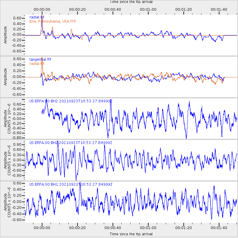
ERPA Erie, Pennsylvania, USA - Earthquake Result Viewer
*The percent match for this event was below the threshold and hence no stack was calculated.
| Earthquake location: |
Gulf Of California |
| Earthquake latitude/longitude: |
23.0/-107.9 |
| Earthquake time(UTC): |
2021/09/23 (266) 16:47:48 GMT |
| Earthquake Depth: |
10 km |
| Earthquake Magnitude: |
5.7 Mwb |
| Earthquake Catalog/Contributor: |
NEIC PDE/us |
|
| Network: |
US United States National Seismic Network |
| Station: |
ERPA Erie, Pennsylvania, USA |
| Lat/Lon: |
42.12 N/79.99 W |
| Elevation: |
306 m |
|
| Distance: |
30.1 deg |
| Az: |
44.062 deg |
| Baz: |
239.459 deg |
| Ray Param: |
$rayparam |
*The percent match for this event was below the threshold and hence was not used in the summary stack. |
|
| Radial Match: |
49.96818 % |
| Radial Bump: |
400 |
| Transverse Match: |
44.521023 % |
| Transverse Bump: |
400 |
| SOD ConfigId: |
25131211 |
| Insert Time: |
2021-10-07 17:06:21.857 +0000 |
| GWidth: |
2.5 |
| Max Bumps: |
400 |
| Tol: |
0.001 |
|
Signal To Noise
| Channel | StoN | STA | LTA |
| US:ERPA:00:BHZ:20210923T16:53:27.84999Z | 1.0989177 | 3.041486E-7 | 2.7677106E-7 |
| US:ERPA:00:BH1:20210923T16:53:27.84999Z | 0.78378516 | 2.987225E-7 | 3.8112805E-7 |
| US:ERPA:00:BH2:20210923T16:53:27.84999Z | 0.7223884 | 1.9289469E-7 | 2.6702352E-7 |
| Arrivals |
| Ps | |
| PpPs | |
| PsPs/PpSs | |


