You are here: Home > Network List > CI - Caltech Regional Seismic Network Stations List
> Station MPM Manuel Prospect Mine, California, USA > Earthquake Result Viewer
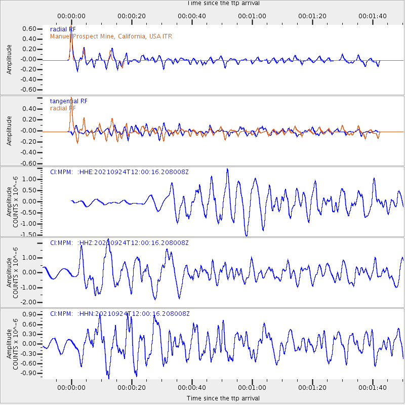
MPM Manuel Prospect Mine, California, USA - Earthquake Result Viewer
*The percent match for this event was below the threshold and hence no stack was calculated.
| Earthquake location: |
Andreanof Islands, Aleutian Is. |
| Earthquake latitude/longitude: |
51.1/-178.9 |
| Earthquake time(UTC): |
2021/09/24 (267) 11:52:31 GMT |
| Earthquake Depth: |
50 km |
| Earthquake Magnitude: |
6.3 Mi |
| Earthquake Catalog/Contributor: |
NEIC PDE/at |
|
| Network: |
CI Caltech Regional Seismic Network |
| Station: |
MPM Manuel Prospect Mine, California, USA |
| Lat/Lon: |
36.06 N/117.49 W |
| Elevation: |
185 m |
|
| Distance: |
45.7 deg |
| Az: |
84.42 deg |
| Baz: |
309.173 deg |
| Ray Param: |
$rayparam |
*The percent match for this event was below the threshold and hence was not used in the summary stack. |
|
| Radial Match: |
79.16438 % |
| Radial Bump: |
400 |
| Transverse Match: |
72.99958 % |
| Transverse Bump: |
400 |
| SOD ConfigId: |
25131211 |
| Insert Time: |
2021-10-08 11:59:34.739 +0000 |
| GWidth: |
2.5 |
| Max Bumps: |
400 |
| Tol: |
0.001 |
|
Signal To Noise
| Channel | StoN | STA | LTA |
| CI:MPM: :HHZ:20210924T12:00:16.208008Z | 3.594049 | 7.252567E-7 | 2.0179378E-7 |
| CI:MPM: :HHN:20210924T12:00:16.208008Z | 3.367292 | 2.7382794E-7 | 8.1319925E-8 |
| CI:MPM: :HHE:20210924T12:00:16.208008Z | 5.771864 | 4.1993897E-7 | 7.2756215E-8 |
| Arrivals |
| Ps | |
| PpPs | |
| PsPs/PpSs | |


