You are here: Home > Network List > G - GEOSCOPE Stations List
> Station INU Inuyama, Japan > Earthquake Result Viewer
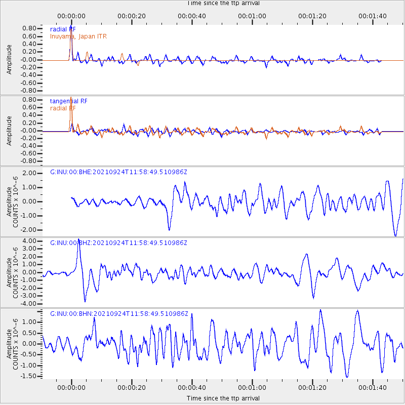
INU Inuyama, Japan - Earthquake Result Viewer
*The percent match for this event was below the threshold and hence no stack was calculated.
| Earthquake location: |
Andreanof Islands, Aleutian Is. |
| Earthquake latitude/longitude: |
51.1/-178.9 |
| Earthquake time(UTC): |
2021/09/24 (267) 11:52:31 GMT |
| Earthquake Depth: |
50 km |
| Earthquake Magnitude: |
6.3 Mi |
| Earthquake Catalog/Contributor: |
NEIC PDE/at |
|
| Network: |
G GEOSCOPE |
| Station: |
INU Inuyama, Japan |
| Lat/Lon: |
35.35 N/137.03 E |
| Elevation: |
132 m |
|
| Distance: |
35.1 deg |
| Az: |
260.767 deg |
| Baz: |
49.65 deg |
| Ray Param: |
$rayparam |
*The percent match for this event was below the threshold and hence was not used in the summary stack. |
|
| Radial Match: |
78.90104 % |
| Radial Bump: |
400 |
| Transverse Match: |
68.406334 % |
| Transverse Bump: |
400 |
| SOD ConfigId: |
25131211 |
| Insert Time: |
2021-10-08 12:03:51.145 +0000 |
| GWidth: |
2.5 |
| Max Bumps: |
400 |
| Tol: |
0.001 |
|
Signal To Noise
| Channel | StoN | STA | LTA |
| G:INU:00:BHZ:20210924T11:58:49.510986Z | 11.18893 | 2.0629875E-6 | 1.8437756E-7 |
| G:INU:00:BHN:20210924T11:58:49.510986Z | 1.894927 | 4.0010178E-7 | 2.1114363E-7 |
| G:INU:00:BHE:20210924T11:58:49.510986Z | 5.067295 | 9.1823176E-7 | 1.8120748E-7 |
| Arrivals |
| Ps | |
| PpPs | |
| PsPs/PpSs | |


