You are here: Home > Network List > US - United States National Seismic Network Stations List
> Station DGMT Dagmar, Montana, USA > Earthquake Result Viewer
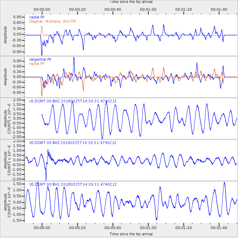
DGMT Dagmar, Montana, USA - Earthquake Result Viewer
*The percent match for this event was below the threshold and hence no stack was calculated.
| Earthquake location: |
Santiago Del Estero Prov., Arg. |
| Earthquake latitude/longitude: |
-26.8/-63.4 |
| Earthquake time(UTC): |
2018/03/25 (084) 14:28:34 GMT |
| Earthquake Depth: |
567 km |
| Earthquake Magnitude: |
5.6 Mww |
| Earthquake Catalog/Contributor: |
NEIC PDE/us |
|
| Network: |
US United States National Seismic Network |
| Station: |
DGMT Dagmar, Montana, USA |
| Lat/Lon: |
48.47 N/104.20 W |
| Elevation: |
0.0 m |
|
| Distance: |
83.4 deg |
| Az: |
334.014 deg |
| Baz: |
143.957 deg |
| Ray Param: |
$rayparam |
*The percent match for this event was below the threshold and hence was not used in the summary stack. |
|
| Radial Match: |
50.062202 % |
| Radial Bump: |
388 |
| Transverse Match: |
43.035736 % |
| Transverse Bump: |
322 |
| SOD ConfigId: |
2615551 |
| Insert Time: |
2018-04-08 14:38:39.734 +0000 |
| GWidth: |
2.5 |
| Max Bumps: |
400 |
| Tol: |
0.001 |
|
Signal To Noise
| Channel | StoN | STA | LTA |
| US:DGMT:00:BHZ:20180325T14:39:31.474021Z | 4.0463195 | 7.17649E-7 | 1.7735847E-7 |
| US:DGMT:00:BH1:20180325T14:39:31.474021Z | 1.3239866 | 8.199752E-7 | 6.1932286E-7 |
| US:DGMT:00:BH2:20180325T14:39:31.474021Z | 1.3274531 | 1.2427238E-6 | 9.3617155E-7 |
| Arrivals |
| Ps | |
| PpPs | |
| PsPs/PpSs | |


