You are here: Home > Network List > CN - Canadian National Seismograph Network Stations List
> Station INK INUVIK, NT > Earthquake Result Viewer
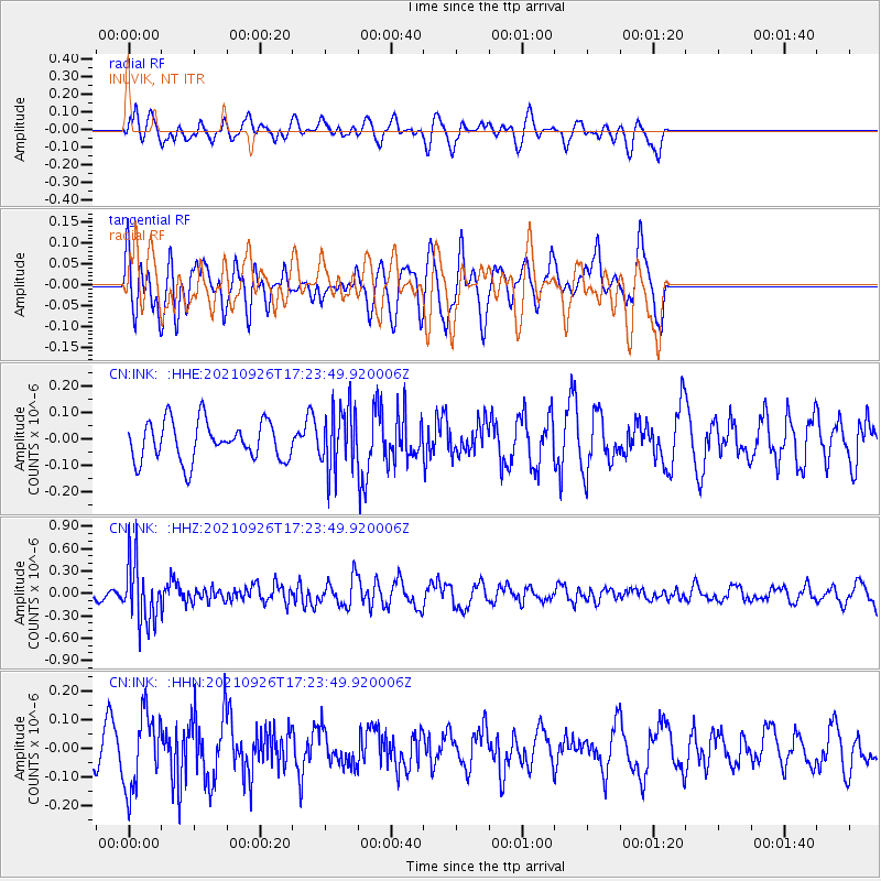
INK INUVIK, NT - Earthquake Result Viewer
*The percent match for this event was below the threshold and hence no stack was calculated.
| Earthquake location: |
Mindoro, Philippines |
| Earthquake latitude/longitude: |
13.9/120.5 |
| Earthquake time(UTC): |
2021/09/26 (269) 17:12:07 GMT |
| Earthquake Depth: |
98 km |
| Earthquake Magnitude: |
5.7 mww |
| Earthquake Catalog/Contributor: |
NEIC PDE/us |
|
| Network: |
CN Canadian National Seismograph Network |
| Station: |
INK INUVIK, NT |
| Lat/Lon: |
68.31 N/133.53 W |
| Elevation: |
44 m |
|
| Distance: |
82.9 deg |
| Az: |
21.115 deg |
| Baz: |
289.811 deg |
| Ray Param: |
$rayparam |
*The percent match for this event was below the threshold and hence was not used in the summary stack. |
|
| Radial Match: |
50.261635 % |
| Radial Bump: |
400 |
| Transverse Match: |
52.269573 % |
| Transverse Bump: |
400 |
| SOD ConfigId: |
25131211 |
| Insert Time: |
2021-10-10 17:20:09.043 +0000 |
| GWidth: |
2.5 |
| Max Bumps: |
400 |
| Tol: |
0.001 |
|
Signal To Noise
| Channel | StoN | STA | LTA |
| CN:INK: :HHZ:20210926T17:23:49.920006Z | 4.8063173 | 4.1340158E-7 | 8.601212E-8 |
| CN:INK: :HHN:20210926T17:23:49.920006Z | 2.4239378 | 1.3134654E-7 | 5.4187257E-8 |
| CN:INK: :HHE:20210926T17:23:49.920006Z | 1.6008525 | 1.1777787E-7 | 7.357197E-8 |
| Arrivals |
| Ps | |
| PpPs | |
| PsPs/PpSs | |


