You are here: Home > Network List > US - United States National Seismic Network Stations List
> Station DGMT Dagmar, Montana, USA > Earthquake Result Viewer
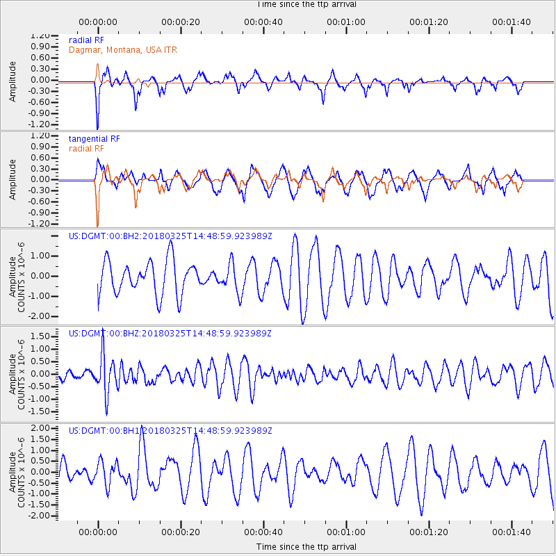
DGMT Dagmar, Montana, USA - Earthquake Result Viewer
*The percent match for this event was below the threshold and hence no stack was calculated.
| Earthquake location: |
Southeast Of Honshu, Japan |
| Earthquake latitude/longitude: |
32.6/140.6 |
| Earthquake time(UTC): |
2018/03/25 (084) 14:37:23 GMT |
| Earthquake Depth: |
51 km |
| Earthquake Magnitude: |
5.7 Mww |
| Earthquake Catalog/Contributor: |
NEIC PDE/us |
|
| Network: |
US United States National Seismic Network |
| Station: |
DGMT Dagmar, Montana, USA |
| Lat/Lon: |
48.47 N/104.20 W |
| Elevation: |
0.0 m |
|
| Distance: |
80.7 deg |
| Az: |
37.617 deg |
| Baz: |
309.27 deg |
| Ray Param: |
$rayparam |
*The percent match for this event was below the threshold and hence was not used in the summary stack. |
|
| Radial Match: |
54.528313 % |
| Radial Bump: |
327 |
| Transverse Match: |
43.32818 % |
| Transverse Bump: |
389 |
| SOD ConfigId: |
2615551 |
| Insert Time: |
2018-04-08 14:44:49.024 +0000 |
| GWidth: |
2.5 |
| Max Bumps: |
400 |
| Tol: |
0.001 |
|
Signal To Noise
| Channel | StoN | STA | LTA |
| US:DGMT:00:BHZ:20180325T14:48:59.923989Z | 3.252745 | 7.73009E-7 | 2.3764821E-7 |
| US:DGMT:00:BH1:20180325T14:48:59.923989Z | 0.9309533 | 5.543143E-7 | 5.954265E-7 |
| US:DGMT:00:BH2:20180325T14:48:59.923989Z | 0.89152306 | 7.3210856E-7 | 8.2118856E-7 |
| Arrivals |
| Ps | |
| PpPs | |
| PsPs/PpSs | |


