You are here: Home > Network List > CI - Caltech Regional Seismic Network Stations List
> Station MPM Manuel Prospect Mine, California, USA > Earthquake Result Viewer
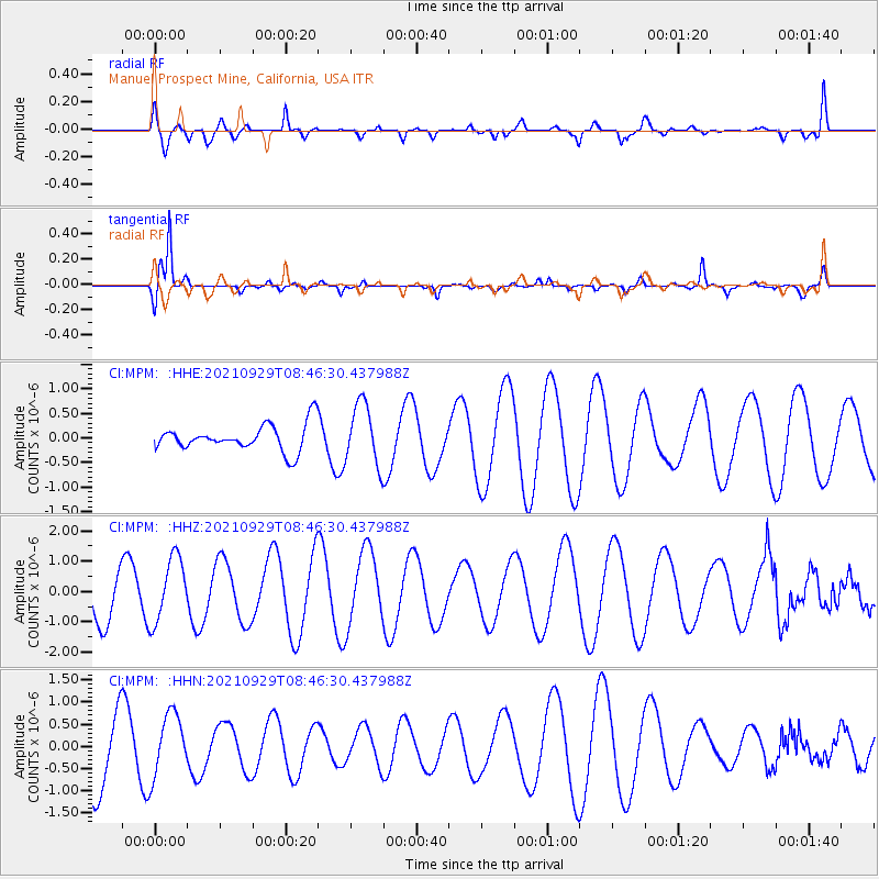
MPM Manuel Prospect Mine, California, USA - Earthquake Result Viewer
*The percent match for this event was below the threshold and hence no stack was calculated.
| Earthquake location: |
East Of Kuril Islands |
| Earthquake latitude/longitude: |
45.8/153.5 |
| Earthquake time(UTC): |
2021/09/29 (272) 08:37:05 GMT |
| Earthquake Depth: |
401 km |
| Earthquake Magnitude: |
6.5 Mi |
| Earthquake Catalog/Contributor: |
NEIC PDE/pt |
|
| Network: |
CI Caltech Regional Seismic Network |
| Station: |
MPM Manuel Prospect Mine, California, USA |
| Lat/Lon: |
36.06 N/117.49 W |
| Elevation: |
185 m |
|
| Distance: |
64.6 deg |
| Az: |
63.725 deg |
| Baz: |
309.272 deg |
| Ray Param: |
$rayparam |
*The percent match for this event was below the threshold and hence was not used in the summary stack. |
|
| Radial Match: |
68.361664 % |
| Radial Bump: |
400 |
| Transverse Match: |
90.6255 % |
| Transverse Bump: |
254 |
| SOD ConfigId: |
25131211 |
| Insert Time: |
2021-10-13 08:43:21.392 +0000 |
| GWidth: |
2.5 |
| Max Bumps: |
400 |
| Tol: |
0.001 |
|
Signal To Noise
| Channel | StoN | STA | LTA |
| CI:MPM: :HHZ:20210929T08:46:30.437988Z | 0.85992736 | 1.0627892E-6 | 1.2359059E-6 |
| CI:MPM: :HHN:20210929T08:46:30.437988Z | 0.7013483 | 6.9950437E-7 | 9.973709E-7 |
| CI:MPM: :HHE:20210929T08:46:30.437988Z | 2.3378932 | 6.2413983E-7 | 2.6696677E-7 |
| Arrivals |
| Ps | |
| PpPs | |
| PsPs/PpSs | |


