You are here: Home > Network List > G - GEOSCOPE Stations List
> Station PPTF Pamatai - Papeete - Tahiti island - French Polynesia, France > Earthquake Result Viewer
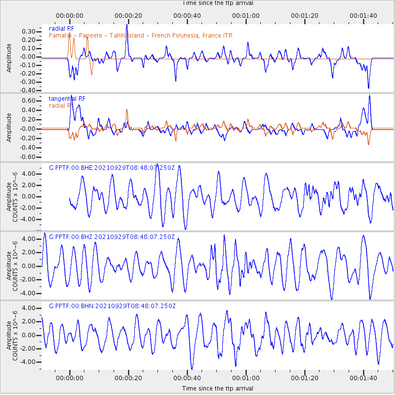
PPTF Pamatai - Papeete - Tahiti island - French Polynesia, France - Earthquake Result Viewer
*The percent match for this event was below the threshold and hence no stack was calculated.
| Earthquake location: |
East Of Kuril Islands |
| Earthquake latitude/longitude: |
45.8/153.5 |
| Earthquake time(UTC): |
2021/09/29 (272) 08:37:05 GMT |
| Earthquake Depth: |
401 km |
| Earthquake Magnitude: |
6.5 Mi |
| Earthquake Catalog/Contributor: |
NEIC PDE/pt |
|
| Network: |
G GEOSCOPE |
| Station: |
PPTF Pamatai - Papeete - Tahiti island - French Polynesia, France |
| Lat/Lon: |
17.59 S/149.57 W |
| Elevation: |
705 m |
|
| Distance: |
81.4 deg |
| Az: |
126.057 deg |
| Baz: |
323.635 deg |
| Ray Param: |
$rayparam |
*The percent match for this event was below the threshold and hence was not used in the summary stack. |
|
| Radial Match: |
62.760166 % |
| Radial Bump: |
400 |
| Transverse Match: |
51.04571 % |
| Transverse Bump: |
400 |
| SOD ConfigId: |
25131211 |
| Insert Time: |
2021-10-13 08:45:32.366 +0000 |
| GWidth: |
2.5 |
| Max Bumps: |
400 |
| Tol: |
0.001 |
|
Signal To Noise
| Channel | StoN | STA | LTA |
| G:PPTF:00:BHZ:20210929T08:48:07.250Z | 1.0336163 | 2.124313E-6 | 2.055224E-6 |
| G:PPTF:00:BHN:20210929T08:48:07.250Z | 0.66043705 | 1.2064263E-6 | 1.8267091E-6 |
| G:PPTF:00:BHE:20210929T08:48:07.250Z | 1.8909105 | 3.402045E-6 | 1.7991571E-6 |
| Arrivals |
| Ps | |
| PpPs | |
| PsPs/PpSs | |


