You are here: Home > Network List > WY - Yellowstone Wyoming Seismic Network Stations List
> Station YUF Upper Falls, WY, USA > Earthquake Result Viewer
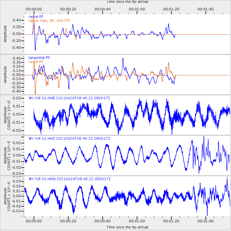
YUF Upper Falls, WY, USA - Earthquake Result Viewer
*The percent match for this event was below the threshold and hence no stack was calculated.
| Earthquake location: |
East Of Kuril Islands |
| Earthquake latitude/longitude: |
45.8/153.5 |
| Earthquake time(UTC): |
2021/09/29 (272) 08:37:05 GMT |
| Earthquake Depth: |
401 km |
| Earthquake Magnitude: |
6.5 Mi |
| Earthquake Catalog/Contributor: |
NEIC PDE/pt |
|
| Network: |
WY Yellowstone Wyoming Seismic Network |
| Station: |
YUF Upper Falls, WY, USA |
| Lat/Lon: |
44.71 N/110.51 W |
| Elevation: |
2394 m |
|
| Distance: |
63.3 deg |
| Az: |
52.523 deg |
| Baz: |
308.863 deg |
| Ray Param: |
$rayparam |
*The percent match for this event was below the threshold and hence was not used in the summary stack. |
|
| Radial Match: |
68.229485 % |
| Radial Bump: |
400 |
| Transverse Match: |
38.13254 % |
| Transverse Bump: |
400 |
| SOD ConfigId: |
25131211 |
| Insert Time: |
2021-10-13 08:57:23.447 +0000 |
| GWidth: |
2.5 |
| Max Bumps: |
400 |
| Tol: |
0.001 |
|
Signal To Noise
| Channel | StoN | STA | LTA |
| WY:YUF:01:HHZ:20210929T08:46:22.080017Z | 0.63181967 | 4.5641397E-9 | 7.223801E-9 |
| WY:YUF:01:HHN:20210929T08:46:22.080017Z | 0.88917553 | 8.084249E-9 | 9.091848E-9 |
| WY:YUF:01:HHE:20210929T08:46:22.080017Z | 1.4264723 | 1.0167617E-8 | 7.1278055E-9 |
| Arrivals |
| Ps | |
| PpPs | |
| PsPs/PpSs | |


