You are here: Home > Network List > CN - Canadian National Seismograph Network Stations List
> Station INK INUVIK, NT > Earthquake Result Viewer
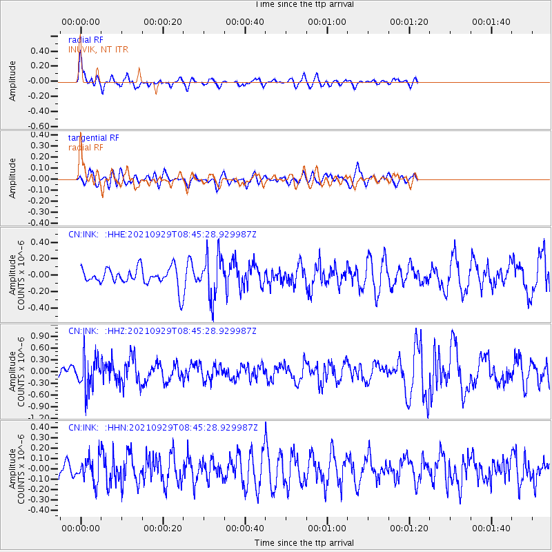
INK INUVIK, NT - Earthquake Result Viewer
*The percent match for this event was below the threshold and hence no stack was calculated.
| Earthquake location: |
Sea Of Japan |
| Earthquake latitude/longitude: |
38.9/135.5 |
| Earthquake time(UTC): |
2021/09/29 (272) 08:37:05 GMT |
| Earthquake Depth: |
368 km |
| Earthquake Magnitude: |
6.1 Mww |
| Earthquake Catalog/Contributor: |
NEIC PDE/us |
|
| Network: |
CN Canadian National Seismograph Network |
| Station: |
INK INUVIK, NT |
| Lat/Lon: |
68.31 N/133.53 W |
| Elevation: |
44 m |
|
| Distance: |
54.9 deg |
| Az: |
27.026 deg |
| Baz: |
287.438 deg |
| Ray Param: |
$rayparam |
*The percent match for this event was below the threshold and hence was not used in the summary stack. |
|
| Radial Match: |
71.11443 % |
| Radial Bump: |
392 |
| Transverse Match: |
46.27918 % |
| Transverse Bump: |
400 |
| SOD ConfigId: |
25131211 |
| Insert Time: |
2021-10-13 09:11:11.184 +0000 |
| GWidth: |
2.5 |
| Max Bumps: |
400 |
| Tol: |
0.001 |
|
Signal To Noise
| Channel | StoN | STA | LTA |
| CN:INK: :HHZ:20210929T08:45:28.929987Z | 3.0893605 | 4.2004217E-7 | 1.3596411E-7 |
| CN:INK: :HHN:20210929T08:45:28.929987Z | 1.2078596 | 1.1899614E-7 | 9.8518186E-8 |
| CN:INK: :HHE:20210929T08:45:28.929987Z | 2.447092 | 2.63833E-7 | 1.078149E-7 |
| Arrivals |
| Ps | |
| PpPs | |
| PsPs/PpSs | |


