You are here: Home > Network List > US - United States National Seismic Network Stations List
> Station DGMT Dagmar, Montana, USA > Earthquake Result Viewer
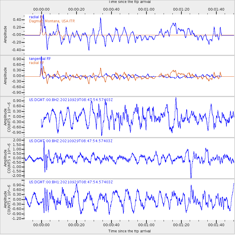
DGMT Dagmar, Montana, USA - Earthquake Result Viewer
*The percent match for this event was below the threshold and hence no stack was calculated.
| Earthquake location: |
Sea Of Japan |
| Earthquake latitude/longitude: |
38.9/135.5 |
| Earthquake time(UTC): |
2021/09/29 (272) 08:37:05 GMT |
| Earthquake Depth: |
368 km |
| Earthquake Magnitude: |
6.1 Mww |
| Earthquake Catalog/Contributor: |
NEIC PDE/us |
|
| Network: |
US United States National Seismic Network |
| Station: |
DGMT Dagmar, Montana, USA |
| Lat/Lon: |
48.47 N/104.20 W |
| Elevation: |
0.0 m |
|
| Distance: |
78.2 deg |
| Az: |
35.924 deg |
| Baz: |
316.514 deg |
| Ray Param: |
$rayparam |
*The percent match for this event was below the threshold and hence was not used in the summary stack. |
|
| Radial Match: |
67.24159 % |
| Radial Bump: |
400 |
| Transverse Match: |
75.98537 % |
| Transverse Bump: |
357 |
| SOD ConfigId: |
25131211 |
| Insert Time: |
2021-10-13 09:25:29.923 +0000 |
| GWidth: |
2.5 |
| Max Bumps: |
400 |
| Tol: |
0.001 |
|
Signal To Noise
| Channel | StoN | STA | LTA |
| US:DGMT:00:BHZ:20210929T08:47:54.57403Z | 2.1929417 | 6.729032E-7 | 3.0684959E-7 |
| US:DGMT:00:BH1:20210929T08:47:54.57403Z | 0.74493325 | 3.8133317E-7 | 5.119025E-7 |
| US:DGMT:00:BH2:20210929T08:47:54.57403Z | 1.3972996 | 4.715402E-7 | 3.3746534E-7 |
| Arrivals |
| Ps | |
| PpPs | |
| PsPs/PpSs | |


