You are here: Home > Network List > US - United States National Seismic Network Stations List
> Station MSO Missoula, Montana, USA > Earthquake Result Viewer
MSO Missoula, Montana, USA - Earthquake Result Viewer
*The percent match for this event was below the threshold and hence no stack was calculated.
| Earthquake location: |
Sea Of Japan |
| Earthquake latitude/longitude: |
38.9/135.5 |
| Earthquake time(UTC): |
2021/09/29 (272) 08:37:05 GMT |
| Earthquake Depth: |
368 km |
| Earthquake Magnitude: |
6.1 Mww |
| Earthquake Catalog/Contributor: |
NEIC PDE/us |
|
| Network: |
US United States National Seismic Network |
| Station: |
MSO Missoula, Montana, USA |
| Lat/Lon: |
46.83 N/113.94 W |
| Elevation: |
1264 m |
|
| Distance: |
74.6 deg |
| Az: |
41.815 deg |
| Baz: |
310.712 deg |
| Ray Param: |
$rayparam |
*The percent match for this event was below the threshold and hence was not used in the summary stack. |
|
| Radial Match: |
65.404854 % |
| Radial Bump: |
400 |
| Transverse Match: |
75.51989 % |
| Transverse Bump: |
400 |
| SOD ConfigId: |
25131211 |
| Insert Time: |
2021-10-13 09:25:51.422 +0000 |
| GWidth: |
2.5 |
| Max Bumps: |
400 |
| Tol: |
0.001 |
|
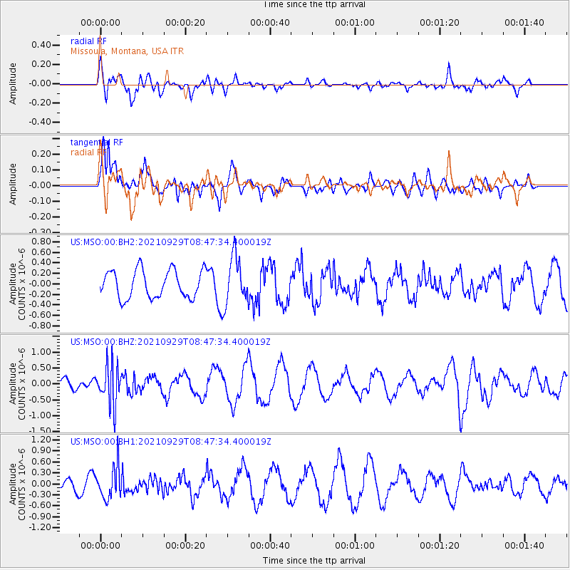
Signal To Noise
| Channel | StoN | STA | LTA |
| US:MSO:00:BHZ:20210929T08:47:34.400019Z | 3.2422757 | 6.396802E-7 | 1.9729357E-7 |
| US:MSO:00:BH1:20210929T08:47:34.400019Z | 2.6037283 | 4.4207925E-7 | 1.6978701E-7 |
| US:MSO:00:BH2:20210929T08:47:34.400019Z | 1.7064213 | 4.4811475E-7 | 2.62605E-7 |
| Arrivals |
| Ps | |
| PpPs | |
| PsPs/PpSs | |


