You are here: Home > Network List > WY - Yellowstone Wyoming Seismic Network Stations List
> Station YHH Holmes Hill, YNP, WY, USA > Earthquake Result Viewer
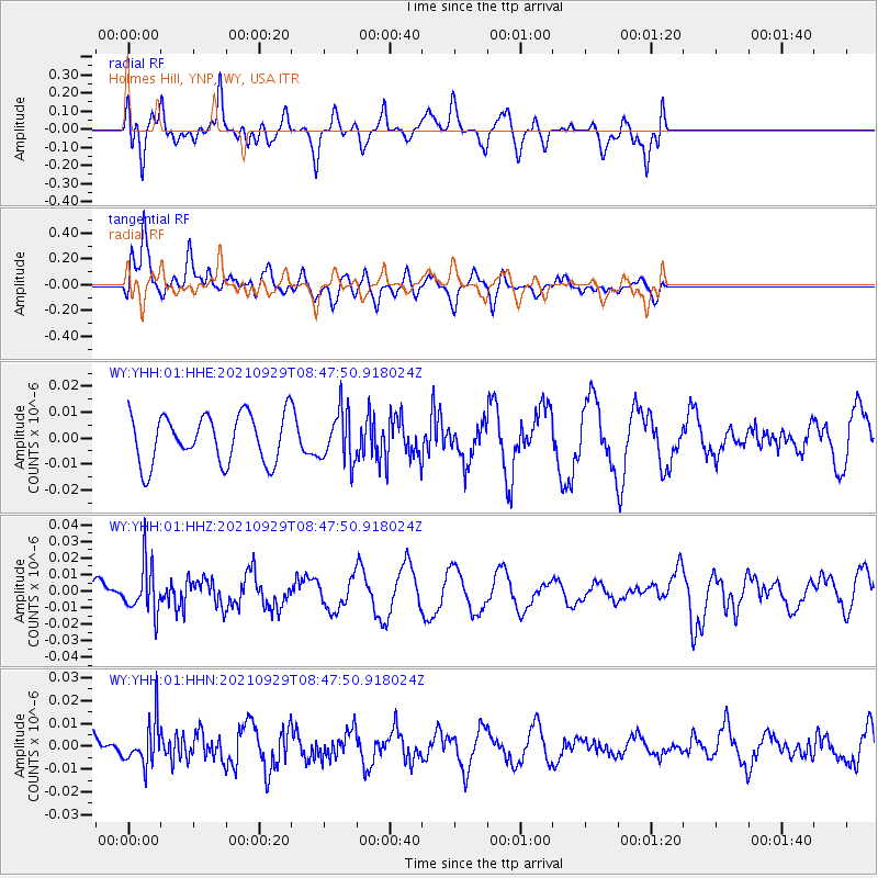
YHH Holmes Hill, YNP, WY, USA - Earthquake Result Viewer
*The percent match for this event was below the threshold and hence no stack was calculated.
| Earthquake location: |
Sea Of Japan |
| Earthquake latitude/longitude: |
38.9/135.5 |
| Earthquake time(UTC): |
2021/09/29 (272) 08:37:05 GMT |
| Earthquake Depth: |
368 km |
| Earthquake Magnitude: |
6.1 Mww |
| Earthquake Catalog/Contributor: |
NEIC PDE/us |
|
| Network: |
WY Yellowstone Wyoming Seismic Network |
| Station: |
YHH Holmes Hill, YNP, WY, USA |
| Lat/Lon: |
44.79 N/110.85 W |
| Elevation: |
2717 m |
|
| Distance: |
77.6 deg |
| Az: |
41.897 deg |
| Baz: |
312.941 deg |
| Ray Param: |
$rayparam |
*The percent match for this event was below the threshold and hence was not used in the summary stack. |
|
| Radial Match: |
73.616684 % |
| Radial Bump: |
400 |
| Transverse Match: |
77.69893 % |
| Transverse Bump: |
400 |
| SOD ConfigId: |
25131211 |
| Insert Time: |
2021-10-13 09:29:12.950 +0000 |
| GWidth: |
2.5 |
| Max Bumps: |
400 |
| Tol: |
0.001 |
|
Signal To Noise
| Channel | StoN | STA | LTA |
| WY:YHH:01:HHZ:20210929T08:47:50.918024Z | 2.086804 | 1.4695167E-8 | 7.041949E-9 |
| WY:YHH:01:HHN:20210929T08:47:50.918024Z | 1.240867 | 9.600583E-9 | 7.736996E-9 |
| WY:YHH:01:HHE:20210929T08:47:50.918024Z | 1.0531377 | 9.771812E-9 | 9.27876E-9 |
| Arrivals |
| Ps | |
| PpPs | |
| PsPs/PpSs | |


