You are here: Home > Network List > AV - Alaska Volcano Observatory Stations List
> Station KAVE Katnai Ventifact, Alaska > Earthquake Result Viewer
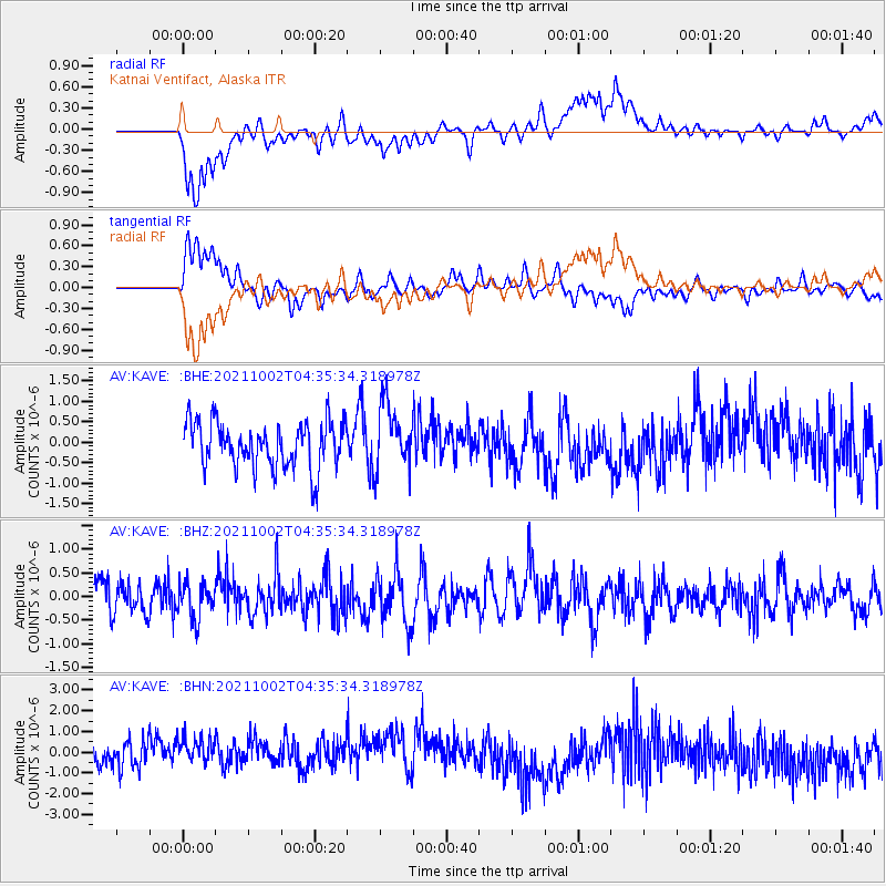
KAVE Katnai Ventifact, Alaska - Earthquake Result Viewer
*The percent match for this event was below the threshold and hence no stack was calculated.
| Earthquake location: |
Samoa Islands Region |
| Earthquake latitude/longitude: |
-14.9/-173.1 |
| Earthquake time(UTC): |
2021/10/02 (275) 04:24:28 GMT |
| Earthquake Depth: |
10 km |
| Earthquake Magnitude: |
5.7 Mww |
| Earthquake Catalog/Contributor: |
NEIC PDE/us |
|
| Network: |
AV Alaska Volcano Observatory |
| Station: |
KAVE Katnai Ventifact, Alaska |
| Lat/Lon: |
58.20 N/155.02 W |
| Elevation: |
702 m |
|
| Distance: |
74.3 deg |
| Az: |
9.829 deg |
| Baz: |
198.161 deg |
| Ray Param: |
$rayparam |
*The percent match for this event was below the threshold and hence was not used in the summary stack. |
|
| Radial Match: |
54.83789 % |
| Radial Bump: |
400 |
| Transverse Match: |
64.96648 % |
| Transverse Bump: |
400 |
| SOD ConfigId: |
25131211 |
| Insert Time: |
2021-10-16 04:27:55.471 +0000 |
| GWidth: |
2.5 |
| Max Bumps: |
400 |
| Tol: |
0.001 |
|
Signal To Noise
| Channel | StoN | STA | LTA |
| AV:KAVE: :BHZ:20211002T04:35:34.318978Z | 1.1338016 | 3.686706E-7 | 3.2516326E-7 |
| AV:KAVE: :BHN:20211002T04:35:34.318978Z | 1.458363 | 1.1441181E-6 | 7.845222E-7 |
| AV:KAVE: :BHE:20211002T04:35:34.318978Z | 1.3850877 | 7.8080734E-7 | 5.6372414E-7 |
| Arrivals |
| Ps | |
| PpPs | |
| PsPs/PpSs | |


