You are here: Home > Network List > US - United States National Seismic Network Stations List
> Station HAWA Hanford, Washington, USA > Earthquake Result Viewer
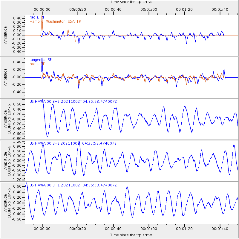
HAWA Hanford, Washington, USA - Earthquake Result Viewer
*The percent match for this event was below the threshold and hence no stack was calculated.
| Earthquake location: |
Samoa Islands Region |
| Earthquake latitude/longitude: |
-14.9/-173.1 |
| Earthquake time(UTC): |
2021/10/02 (275) 04:24:28 GMT |
| Earthquake Depth: |
10 km |
| Earthquake Magnitude: |
5.7 Mww |
| Earthquake Catalog/Contributor: |
NEIC PDE/us |
|
| Network: |
US United States National Seismic Network |
| Station: |
HAWA Hanford, Washington, USA |
| Lat/Lon: |
46.39 N/119.53 W |
| Elevation: |
364 m |
|
| Distance: |
77.7 deg |
| Az: |
34.75 deg |
| Baz: |
232.772 deg |
| Ray Param: |
$rayparam |
*The percent match for this event was below the threshold and hence was not used in the summary stack. |
|
| Radial Match: |
51.195827 % |
| Radial Bump: |
400 |
| Transverse Match: |
55.668034 % |
| Transverse Bump: |
325 |
| SOD ConfigId: |
25131211 |
| Insert Time: |
2021-10-16 04:39:18.183 +0000 |
| GWidth: |
2.5 |
| Max Bumps: |
400 |
| Tol: |
0.001 |
|
Signal To Noise
| Channel | StoN | STA | LTA |
| US:HAWA:00:BHZ:20211002T04:35:53.474007Z | 2.2140987 | 6.68455E-7 | 3.0190841E-7 |
| US:HAWA:00:BH1:20211002T04:35:53.474007Z | 0.8098203 | 2.5512549E-7 | 3.150396E-7 |
| US:HAWA:00:BH2:20211002T04:35:53.474007Z | 0.73830366 | 2.7265196E-7 | 3.6929512E-7 |
| Arrivals |
| Ps | |
| PpPs | |
| PsPs/PpSs | |


