You are here: Home > Network List > UW - Pacific Northwest Regional Seismic Network Stations List
> Station IRON Crane, OR, USA > Earthquake Result Viewer
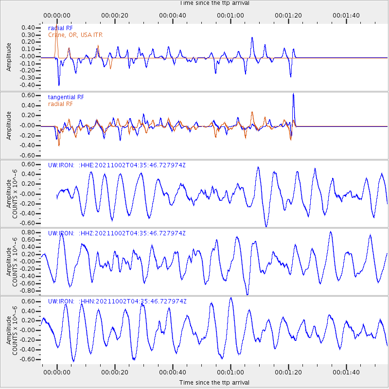
IRON Crane, OR, USA - Earthquake Result Viewer
*The percent match for this event was below the threshold and hence no stack was calculated.
| Earthquake location: |
Samoa Islands Region |
| Earthquake latitude/longitude: |
-14.9/-173.1 |
| Earthquake time(UTC): |
2021/10/02 (275) 04:24:28 GMT |
| Earthquake Depth: |
10 km |
| Earthquake Magnitude: |
5.7 Mww |
| Earthquake Catalog/Contributor: |
NEIC PDE/us |
|
| Network: |
UW Pacific Northwest Regional Seismic Network |
| Station: |
IRON Crane, OR, USA |
| Lat/Lon: |
43.36 N/118.47 W |
| Elevation: |
1226 m |
|
| Distance: |
76.5 deg |
| Az: |
37.711 deg |
| Baz: |
234.178 deg |
| Ray Param: |
$rayparam |
*The percent match for this event was below the threshold and hence was not used in the summary stack. |
|
| Radial Match: |
47.495243 % |
| Radial Bump: |
315 |
| Transverse Match: |
62.770622 % |
| Transverse Bump: |
385 |
| SOD ConfigId: |
25131211 |
| Insert Time: |
2021-10-16 04:39:49.828 +0000 |
| GWidth: |
2.5 |
| Max Bumps: |
400 |
| Tol: |
0.001 |
|
Signal To Noise
| Channel | StoN | STA | LTA |
| UW:IRON: :HHZ:20211002T04:35:46.727974Z | 2.515885 | 5.167258E-7 | 2.0538529E-7 |
| UW:IRON: :HHN:20211002T04:35:46.727974Z | 1.2895596 | 3.1247168E-7 | 2.4230883E-7 |
| UW:IRON: :HHE:20211002T04:35:46.727974Z | 1.2091497 | 3.0948837E-7 | 2.5595537E-7 |
| Arrivals |
| Ps | |
| PpPs | |
| PsPs/PpSs | |


