You are here: Home > Network List > US - United States National Seismic Network Stations List
> Station HAWA Hanford, Washington, USA > Earthquake Result Viewer
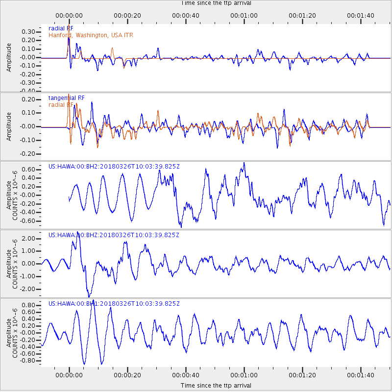
HAWA Hanford, Washington, USA - Earthquake Result Viewer
*The percent match for this event was below the threshold and hence no stack was calculated.
| Earthquake location: |
New Britain Region, P.N.G. |
| Earthquake latitude/longitude: |
-5.5/151.4 |
| Earthquake time(UTC): |
2018/03/26 (085) 09:51:00 GMT |
| Earthquake Depth: |
40 km |
| Earthquake Magnitude: |
6.6 mww |
| Earthquake Catalog/Contributor: |
NEIC PDE/us |
|
| Network: |
US United States National Seismic Network |
| Station: |
HAWA Hanford, Washington, USA |
| Lat/Lon: |
46.39 N/119.53 W |
| Elevation: |
364 m |
|
| Distance: |
93.3 deg |
| Az: |
43.882 deg |
| Baz: |
265.572 deg |
| Ray Param: |
$rayparam |
*The percent match for this event was below the threshold and hence was not used in the summary stack. |
|
| Radial Match: |
60.104004 % |
| Radial Bump: |
400 |
| Transverse Match: |
64.52878 % |
| Transverse Bump: |
400 |
| SOD ConfigId: |
2615551 |
| Insert Time: |
2018-04-09 09:54:28.185 +0000 |
| GWidth: |
2.5 |
| Max Bumps: |
400 |
| Tol: |
0.001 |
|
Signal To Noise
| Channel | StoN | STA | LTA |
| US:HAWA:00:BHZ:20180326T10:03:39.825Z | 6.700256 | 1.3872435E-6 | 2.0704336E-7 |
| US:HAWA:00:BH1:20180326T10:03:39.825Z | 1.4928988 | 3.903447E-7 | 2.6146762E-7 |
| US:HAWA:00:BH2:20180326T10:03:39.825Z | 1.1733867 | 3.4969608E-7 | 2.9802288E-7 |
| Arrivals |
| Ps | |
| PpPs | |
| PsPs/PpSs | |


