You are here: Home > Network List > CI - Caltech Regional Seismic Network Stations List
> Station MPM Manuel Prospect Mine, California, USA > Earthquake Result Viewer
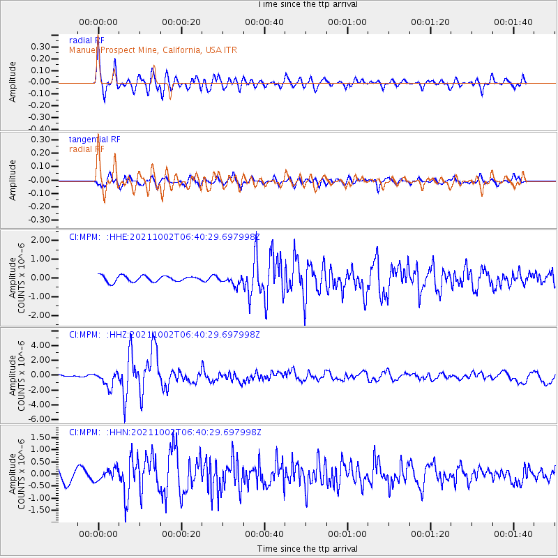
MPM Manuel Prospect Mine, California, USA - Earthquake Result Viewer
*The percent match for this event was below the threshold and hence no stack was calculated.
| Earthquake location: |
Vanuatu Islands Region |
| Earthquake latitude/longitude: |
-20.9/174.9 |
| Earthquake time(UTC): |
2021/10/02 (275) 06:29:16 GMT |
| Earthquake Depth: |
486 km |
| Earthquake Magnitude: |
7.2 Mi |
| Earthquake Catalog/Contributor: |
NEIC PDE/pt |
|
| Network: |
CI Caltech Regional Seismic Network |
| Station: |
MPM Manuel Prospect Mine, California, USA |
| Lat/Lon: |
36.06 N/117.49 W |
| Elevation: |
185 m |
|
| Distance: |
85.3 deg |
| Az: |
48.727 deg |
| Baz: |
240.159 deg |
| Ray Param: |
$rayparam |
*The percent match for this event was below the threshold and hence was not used in the summary stack. |
|
| Radial Match: |
79.10793 % |
| Radial Bump: |
400 |
| Transverse Match: |
53.446705 % |
| Transverse Bump: |
400 |
| SOD ConfigId: |
25131211 |
| Insert Time: |
2021-10-16 06:41:37.325 +0000 |
| GWidth: |
2.5 |
| Max Bumps: |
400 |
| Tol: |
0.001 |
|
Signal To Noise
| Channel | StoN | STA | LTA |
| CI:MPM: :HHZ:20211002T06:40:29.697998Z | 5.4527164 | 1.0635998E-6 | 1.950587E-7 |
| CI:MPM: :HHN:20211002T06:40:29.697998Z | 0.9517105 | 2.3136059E-7 | 2.4309975E-7 |
| CI:MPM: :HHE:20211002T06:40:29.697998Z | 1.6768872 | 2.588124E-7 | 1.5434098E-7 |
| Arrivals |
| Ps | |
| PpPs | |
| PsPs/PpSs | |


