You are here: Home > Network List > CN - Canadian National Seismograph Network Stations List
> Station INK INUVIK, NT > Earthquake Result Viewer
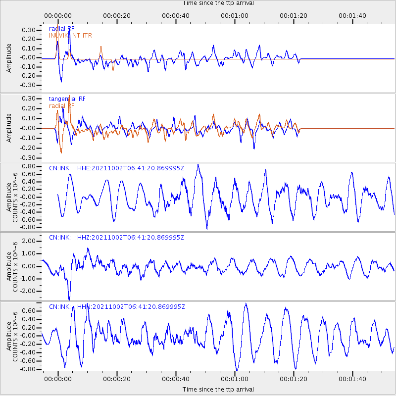
INK INUVIK, NT - Earthquake Result Viewer
*The percent match for this event was below the threshold and hence no stack was calculated.
| Earthquake location: |
Vanuatu Islands Region |
| Earthquake latitude/longitude: |
-20.9/174.9 |
| Earthquake time(UTC): |
2021/10/02 (275) 06:29:16 GMT |
| Earthquake Depth: |
486 km |
| Earthquake Magnitude: |
7.2 Mi |
| Earthquake Catalog/Contributor: |
NEIC PDE/pt |
|
| Network: |
CN Canadian National Seismograph Network |
| Station: |
INK INUVIK, NT |
| Lat/Lon: |
68.31 N/133.53 W |
| Elevation: |
44 m |
|
| Distance: |
96.5 deg |
| Az: |
17.039 deg |
| Baz: |
227.482 deg |
| Ray Param: |
$rayparam |
*The percent match for this event was below the threshold and hence was not used in the summary stack. |
|
| Radial Match: |
65.69242 % |
| Radial Bump: |
400 |
| Transverse Match: |
61.931858 % |
| Transverse Bump: |
303 |
| SOD ConfigId: |
25131211 |
| Insert Time: |
2021-10-16 06:42:46.106 +0000 |
| GWidth: |
2.5 |
| Max Bumps: |
400 |
| Tol: |
0.001 |
|
Signal To Noise
| Channel | StoN | STA | LTA |
| CN:INK: :HHZ:20211002T06:41:20.869995Z | 2.2255316 | 1.0553778E-6 | 4.742138E-7 |
| CN:INK: :HHN:20211002T06:41:20.869995Z | 1.368532 | 3.8774377E-7 | 2.8332826E-7 |
| CN:INK: :HHE:20211002T06:41:20.869995Z | 0.89940435 | 2.7397053E-7 | 3.046133E-7 |
| Arrivals |
| Ps | |
| PpPs | |
| PsPs/PpSs | |


