You are here: Home > Network List > IW - Intermountain West Stations List
> Station MOOW Moose Ponds, Wyoming, USA > Earthquake Result Viewer
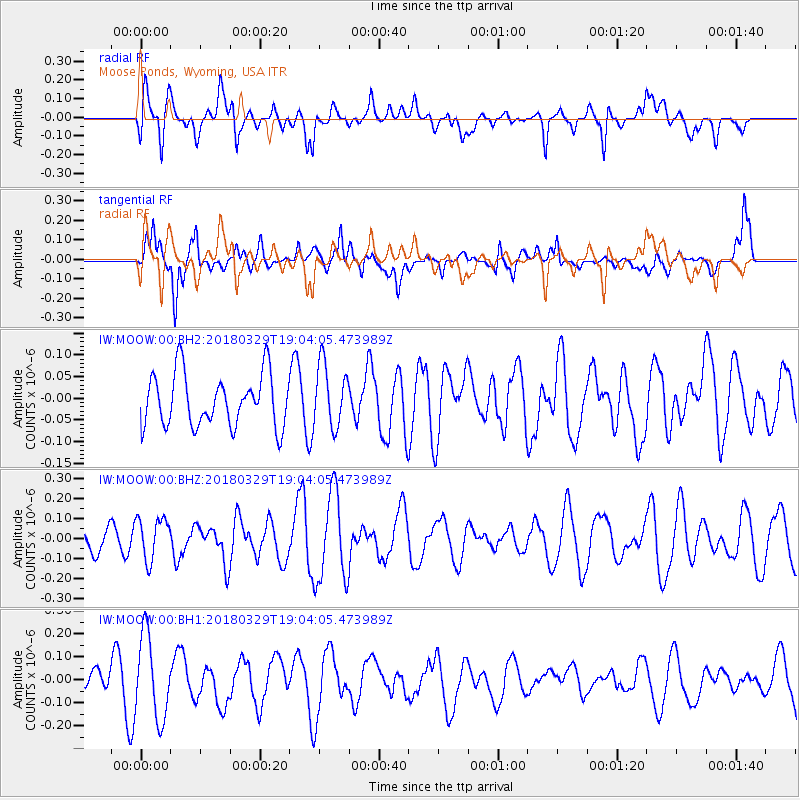
MOOW Moose Ponds, Wyoming, USA - Earthquake Result Viewer
*The percent match for this event was below the threshold and hence no stack was calculated.
| Earthquake location: |
Solomon Islands |
| Earthquake latitude/longitude: |
-9.4/159.6 |
| Earthquake time(UTC): |
2018/03/29 (088) 18:51:09 GMT |
| Earthquake Depth: |
10 km |
| Earthquake Magnitude: |
5.8 Mww |
| Earthquake Catalog/Contributor: |
NEIC PDE/us |
|
| Network: |
IW Intermountain West |
| Station: |
MOOW Moose Ponds, Wyoming, USA |
| Lat/Lon: |
43.75 N/110.74 W |
| Elevation: |
2128 m |
|
| Distance: |
96.2 deg |
| Az: |
46.8 deg |
| Baz: |
262.983 deg |
| Ray Param: |
$rayparam |
*The percent match for this event was below the threshold and hence was not used in the summary stack. |
|
| Radial Match: |
60.526104 % |
| Radial Bump: |
400 |
| Transverse Match: |
53.614532 % |
| Transverse Bump: |
400 |
| SOD ConfigId: |
2615551 |
| Insert Time: |
2018-04-12 18:53:31.963 +0000 |
| GWidth: |
2.5 |
| Max Bumps: |
400 |
| Tol: |
0.001 |
|
Signal To Noise
| Channel | StoN | STA | LTA |
| IW:MOOW:00:BHZ:20180329T19:04:05.473989Z | 1.6348827 | 1.060402E-7 | 6.486105E-8 |
| IW:MOOW:00:BH1:20180329T19:04:05.473989Z | 3.800363 | 1.8079518E-7 | 4.7573135E-8 |
| IW:MOOW:00:BH2:20180329T19:04:05.473989Z | 1.2025958 | 7.27668E-8 | 6.0508114E-8 |
| Arrivals |
| Ps | |
| PpPs | |
| PsPs/PpSs | |


