You are here: Home > Network List > IU - Global Seismograph Network (GSN - IRIS/USGS) Stations List
> Station JOHN Johnston Island, USA > Earthquake Result Viewer
JOHN Johnston Island, USA - Earthquake Result Viewer
*The percent match for this event was below the threshold and hence no stack was calculated.
| Earthquake location: |
Vanuatu Islands Region |
| Earthquake latitude/longitude: |
-20.9/174.9 |
| Earthquake time(UTC): |
2021/10/02 (275) 06:29:16 GMT |
| Earthquake Depth: |
486 km |
| Earthquake Magnitude: |
7.2 Mi |
| Earthquake Catalog/Contributor: |
NEIC PDE/pt |
|
| Network: |
IU Global Seismograph Network (GSN - IRIS/USGS) |
| Station: |
JOHN Johnston Island, USA |
| Lat/Lon: |
16.73 N/169.53 W |
| Elevation: |
2.0 m |
|
| Distance: |
40.4 deg |
| Az: |
23.36 deg |
| Baz: |
202.767 deg |
| Ray Param: |
$rayparam |
*The percent match for this event was below the threshold and hence was not used in the summary stack. |
|
| Radial Match: |
66.55713 % |
| Radial Bump: |
400 |
| Transverse Match: |
69.39069 % |
| Transverse Bump: |
400 |
| SOD ConfigId: |
25131211 |
| Insert Time: |
2021-10-16 06:45:02.978 +0000 |
| GWidth: |
2.5 |
| Max Bumps: |
400 |
| Tol: |
0.001 |
|
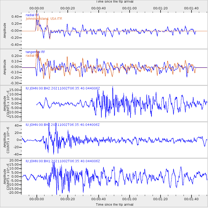
Signal To Noise
| Channel | StoN | STA | LTA |
| IU:JOHN:00:BHZ:20211002T06:35:40.044006Z | 1.8725544 | 4.203459E-6 | 2.2447728E-6 |
| IU:JOHN:00:BH1:20211002T06:35:40.044006Z | 0.92473555 | 1.779013E-6 | 1.9238073E-6 |
| IU:JOHN:00:BH2:20211002T06:35:40.044006Z | 1.08623 | 2.3115508E-6 | 2.1280491E-6 |
| Arrivals |
| Ps | |
| PpPs | |
| PsPs/PpSs | |


