You are here: Home > Network List > CI - Caltech Regional Seismic Network Stations List
> Station GMR Granite Mountains Research Center > Earthquake Result Viewer
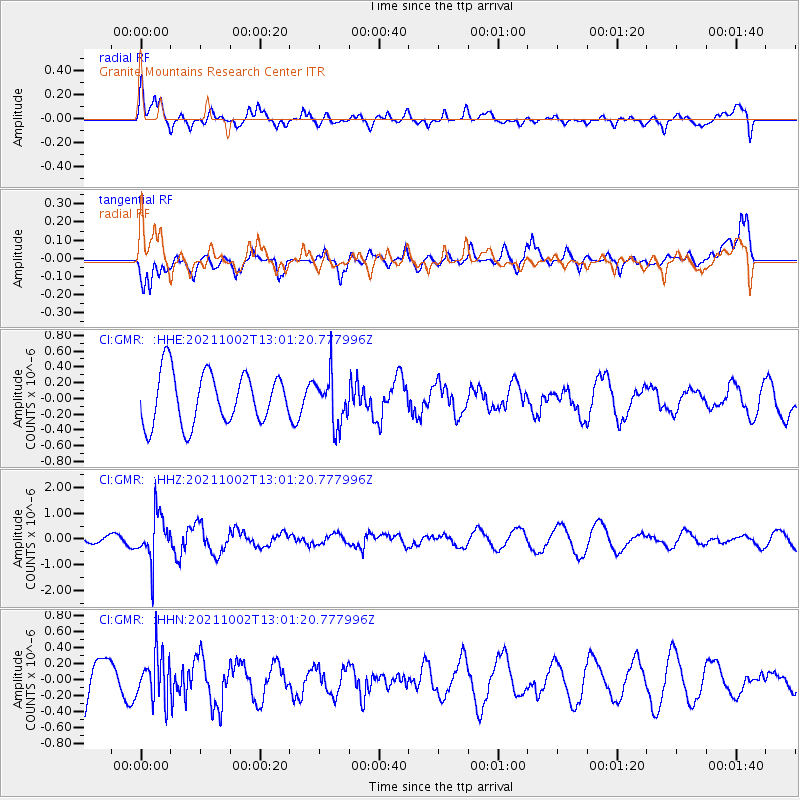
GMR Granite Mountains Research Center - Earthquake Result Viewer
*The percent match for this event was below the threshold and hence no stack was calculated.
| Earthquake location: |
Peru-Brazil Border Region |
| Earthquake latitude/longitude: |
-9.6/-71.2 |
| Earthquake time(UTC): |
2021/10/02 (275) 12:52:34 GMT |
| Earthquake Depth: |
589 km |
| Earthquake Magnitude: |
5.9 mww |
| Earthquake Catalog/Contributor: |
NEIC PDE/us |
|
| Network: |
CI Caltech Regional Seismic Network |
| Station: |
GMR Granite Mountains Research Center |
| Lat/Lon: |
34.78 N/115.66 W |
| Elevation: |
1326 m |
|
| Distance: |
61.0 deg |
| Az: |
318.742 deg |
| Baz: |
127.805 deg |
| Ray Param: |
$rayparam |
*The percent match for this event was below the threshold and hence was not used in the summary stack. |
|
| Radial Match: |
46.56708 % |
| Radial Bump: |
400 |
| Transverse Match: |
49.893005 % |
| Transverse Bump: |
400 |
| SOD ConfigId: |
25131211 |
| Insert Time: |
2021-10-16 12:59:24.085 +0000 |
| GWidth: |
2.5 |
| Max Bumps: |
400 |
| Tol: |
0.001 |
|
Signal To Noise
| Channel | StoN | STA | LTA |
| CI:GMR: :HHZ:20211002T13:01:20.777996Z | 3.7889955 | 9.0535053E-7 | 2.389421E-7 |
| CI:GMR: :HHN:20211002T13:01:20.777996Z | 0.6530045 | 2.930938E-7 | 4.4883885E-7 |
| CI:GMR: :HHE:20211002T13:01:20.777996Z | 0.96217716 | 3.12299E-7 | 3.2457538E-7 |
| Arrivals |
| Ps | |
| PpPs | |
| PsPs/PpSs | |


