You are here: Home > Network List > CI - Caltech Regional Seismic Network Stations List
> Station SMM Simmler, CA, USA > Earthquake Result Viewer
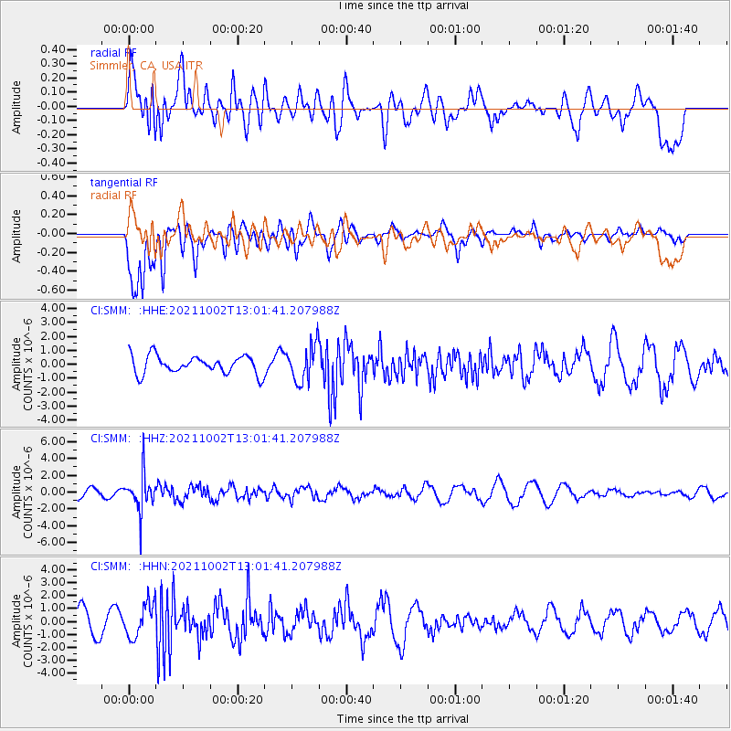
SMM Simmler, CA, USA - Earthquake Result Viewer
*The percent match for this event was below the threshold and hence no stack was calculated.
| Earthquake location: |
Peru-Brazil Border Region |
| Earthquake latitude/longitude: |
-9.6/-71.2 |
| Earthquake time(UTC): |
2021/10/02 (275) 12:52:34 GMT |
| Earthquake Depth: |
589 km |
| Earthquake Magnitude: |
5.9 mww |
| Earthquake Catalog/Contributor: |
NEIC PDE/us |
|
| Network: |
CI Caltech Regional Seismic Network |
| Station: |
SMM Simmler, CA, USA |
| Lat/Lon: |
35.31 N/120.00 W |
| Elevation: |
599 m |
|
| Distance: |
64.2 deg |
| Az: |
316.86 deg |
| Baz: |
124.458 deg |
| Ray Param: |
$rayparam |
*The percent match for this event was below the threshold and hence was not used in the summary stack. |
|
| Radial Match: |
48.299686 % |
| Radial Bump: |
400 |
| Transverse Match: |
67.40703 % |
| Transverse Bump: |
400 |
| SOD ConfigId: |
25131211 |
| Insert Time: |
2021-10-16 13:00:08.807 +0000 |
| GWidth: |
2.5 |
| Max Bumps: |
400 |
| Tol: |
0.001 |
|
Signal To Noise
| Channel | StoN | STA | LTA |
| CI:SMM: :HHZ:20211002T13:01:41.207988Z | 4.15893 | 2.132096E-6 | 5.1265494E-7 |
| CI:SMM: :HHN:20211002T13:01:41.207988Z | 1.2586937 | 1.3220466E-6 | 1.0503323E-6 |
| CI:SMM: :HHE:20211002T13:01:41.207988Z | 2.0144134 | 1.3032462E-6 | 6.4696064E-7 |
| Arrivals |
| Ps | |
| PpPs | |
| PsPs/PpSs | |


