You are here: Home > Network List > CN - Canadian National Seismograph Network Stations List
> Station INK INUVIK, NT > Earthquake Result Viewer
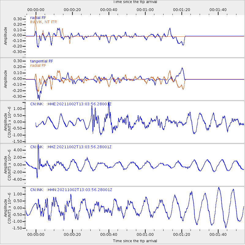
INK INUVIK, NT - Earthquake Result Viewer
*The percent match for this event was below the threshold and hence no stack was calculated.
| Earthquake location: |
Peru-Brazil Border Region |
| Earthquake latitude/longitude: |
-9.6/-71.2 |
| Earthquake time(UTC): |
2021/10/02 (275) 12:52:34 GMT |
| Earthquake Depth: |
589 km |
| Earthquake Magnitude: |
5.9 mww |
| Earthquake Catalog/Contributor: |
NEIC PDE/us |
|
| Network: |
CN Canadian National Seismograph Network |
| Station: |
INK INUVIK, NT |
| Lat/Lon: |
68.31 N/133.53 W |
| Elevation: |
44 m |
|
| Distance: |
89.1 deg |
| Az: |
340.771 deg |
| Baz: |
119.119 deg |
| Ray Param: |
$rayparam |
*The percent match for this event was below the threshold and hence was not used in the summary stack. |
|
| Radial Match: |
59.24271 % |
| Radial Bump: |
400 |
| Transverse Match: |
86.3118 % |
| Transverse Bump: |
400 |
| SOD ConfigId: |
25131211 |
| Insert Time: |
2021-10-16 13:01:13.364 +0000 |
| GWidth: |
2.5 |
| Max Bumps: |
400 |
| Tol: |
0.001 |
|
Signal To Noise
| Channel | StoN | STA | LTA |
| CN:INK: :HHZ:20211002T13:03:56.28001Z | 1.6808115 | 1.7791809E-6 | 1.058525E-6 |
| CN:INK: :HHN:20211002T13:03:56.28001Z | 0.56179386 | 3.2773397E-7 | 5.8337054E-7 |
| CN:INK: :HHE:20211002T13:03:56.28001Z | 1.9829046 | 5.268116E-7 | 2.6567673E-7 |
| Arrivals |
| Ps | |
| PpPs | |
| PsPs/PpSs | |


