You are here: Home > Network List > CN - Canadian National Seismograph Network Stations List
> Station ULM LAC DU BONNET, MB > Earthquake Result Viewer
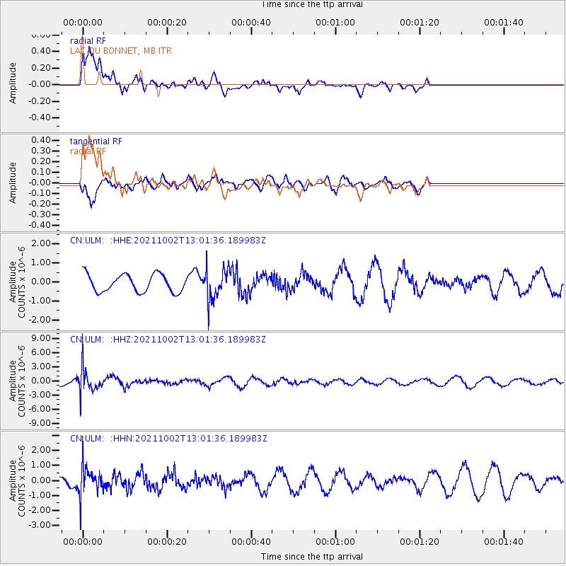
ULM LAC DU BONNET, MB - Earthquake Result Viewer
*The percent match for this event was below the threshold and hence no stack was calculated.
| Earthquake location: |
Peru-Brazil Border Region |
| Earthquake latitude/longitude: |
-9.6/-71.2 |
| Earthquake time(UTC): |
2021/10/02 (275) 12:52:34 GMT |
| Earthquake Depth: |
589 km |
| Earthquake Magnitude: |
5.9 mww |
| Earthquake Catalog/Contributor: |
NEIC PDE/us |
|
| Network: |
CN Canadian National Seismograph Network |
| Station: |
ULM LAC DU BONNET, MB |
| Lat/Lon: |
50.25 N/95.88 W |
| Elevation: |
251 m |
|
| Distance: |
63.4 deg |
| Az: |
342.543 deg |
| Baz: |
152.559 deg |
| Ray Param: |
$rayparam |
*The percent match for this event was below the threshold and hence was not used in the summary stack. |
|
| Radial Match: |
60.5114 % |
| Radial Bump: |
400 |
| Transverse Match: |
66.08887 % |
| Transverse Bump: |
400 |
| SOD ConfigId: |
25131211 |
| Insert Time: |
2021-10-16 13:02:01.478 +0000 |
| GWidth: |
2.5 |
| Max Bumps: |
400 |
| Tol: |
0.001 |
|
Signal To Noise
| Channel | StoN | STA | LTA |
| CN:ULM: :HHZ:20211002T13:01:36.189983Z | 4.0576334 | 2.435931E-6 | 6.0033295E-7 |
| CN:ULM: :HHN:20211002T13:01:36.189983Z | 3.1915996 | 9.2586055E-7 | 2.9009294E-7 |
| CN:ULM: :HHE:20211002T13:01:36.189983Z | 1.8184208 | 8.305027E-7 | 4.5671644E-7 |
| Arrivals |
| Ps | |
| PpPs | |
| PsPs/PpSs | |


