You are here: Home > Network List > UW - Pacific Northwest Regional Seismic Network Stations List
> Station LEBA Lebam, WA, USA > Earthquake Result Viewer
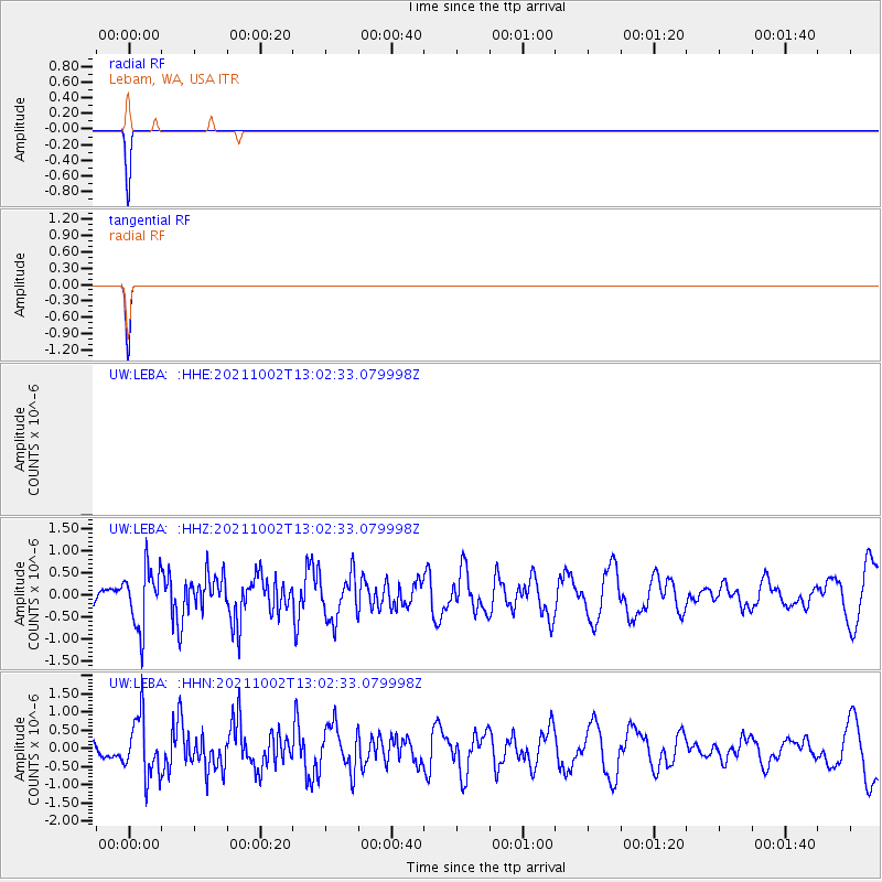
LEBA Lebam, WA, USA - Earthquake Result Viewer
*The percent match for this event was below the threshold and hence no stack was calculated.
| Earthquake location: |
Peru-Brazil Border Region |
| Earthquake latitude/longitude: |
-9.6/-71.2 |
| Earthquake time(UTC): |
2021/10/02 (275) 12:52:34 GMT |
| Earthquake Depth: |
589 km |
| Earthquake Magnitude: |
5.9 mww |
| Earthquake Catalog/Contributor: |
NEIC PDE/us |
|
| Network: |
UW Pacific Northwest Regional Seismic Network |
| Station: |
LEBA Lebam, WA, USA |
| Lat/Lon: |
46.55 N/123.56 W |
| Elevation: |
73 m |
|
| Distance: |
72.8 deg |
| Az: |
325.092 deg |
| Baz: |
125.149 deg |
| Ray Param: |
$rayparam |
*The percent match for this event was below the threshold and hence was not used in the summary stack. |
|
| Radial Match: |
99.90241 % |
| Radial Bump: |
7 |
| Transverse Match: |
99.90241 % |
| Transverse Bump: |
7 |
| SOD ConfigId: |
25131211 |
| Insert Time: |
2021-10-16 13:19:04.781 +0000 |
| GWidth: |
2.5 |
| Max Bumps: |
400 |
| Tol: |
0.001 |
|
Signal To Noise
| Channel | StoN | STA | LTA |
| UW:LEBA: :HHZ:20211002T13:02:33.079998Z | 2.1739802 | 6.8061064E-7 | 3.1307124E-7 |
| UW:LEBA: :HHN:20211002T13:02:33.079998Z | 2.1542366 | 8.133608E-7 | 3.7756337E-7 |
| $trig.getChannelId() | $trig.getValue() | $trig.getSTA() | $trig.getLTA() |
| Arrivals |
| Ps | |
| PpPs | |
| PsPs/PpSs | |


