
PHID YL.PHID - Earthquake Result Viewer
| ||||||||||||||||||
| ||||||||||||||||||
| ||||||||||||||||||
|
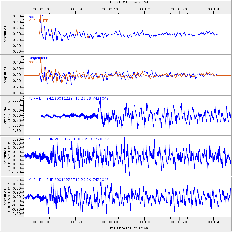
Signal To Noise
| Channel | StoN | STA | LTA |
| YL:PHID: :BHN:20011223T10:29:29.742004Z | 1.8383932 | 1.8392213E-7 | 1.0004504E-7 |
| YL:PHID: :BHE:20011223T10:29:29.742004Z | 4.302859 | 3.282728E-7 | 7.629179E-8 |
| YL:PHID: :BHZ:20011223T10:29:29.742004Z | 6.497677 | 6.143592E-7 | 9.455059E-8 |
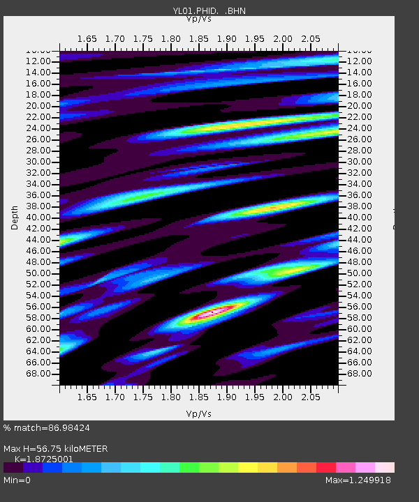
| Arrivals | |
| Ps | 8.4 SECOND |
| PpPs | 25 SECOND |
| PsPs/PpSs | 33 SECOND |

