You are here: Home > Network List > US - United States National Seismic Network Stations List
> Station ERPA Erie, Pennsylvania, USA > Earthquake Result Viewer
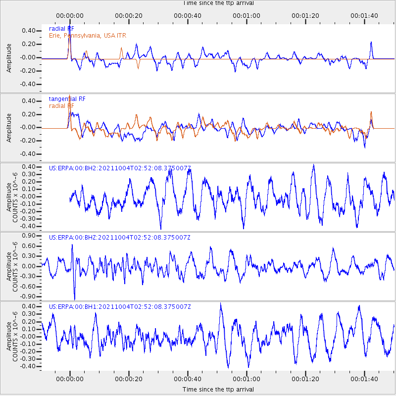
ERPA Erie, Pennsylvania, USA - Earthquake Result Viewer
*The percent match for this event was below the threshold and hence no stack was calculated.
| Earthquake location: |
Western Iran |
| Earthquake latitude/longitude: |
32.3/49.8 |
| Earthquake time(UTC): |
2021/10/04 (277) 02:39:27 GMT |
| Earthquake Depth: |
10 km |
| Earthquake Magnitude: |
5.6 mww |
| Earthquake Catalog/Contributor: |
NEIC PDE/us |
|
| Network: |
US United States National Seismic Network |
| Station: |
ERPA Erie, Pennsylvania, USA |
| Lat/Lon: |
42.12 N/79.99 W |
| Elevation: |
306 m |
|
| Distance: |
92.7 deg |
| Az: |
325.057 deg |
| Baz: |
40.704 deg |
| Ray Param: |
$rayparam |
*The percent match for this event was below the threshold and hence was not used in the summary stack. |
|
| Radial Match: |
56.26386 % |
| Radial Bump: |
400 |
| Transverse Match: |
56.794327 % |
| Transverse Bump: |
400 |
| SOD ConfigId: |
25131211 |
| Insert Time: |
2021-10-18 02:53:38.308 +0000 |
| GWidth: |
2.5 |
| Max Bumps: |
400 |
| Tol: |
0.001 |
|
Signal To Noise
| Channel | StoN | STA | LTA |
| US:ERPA:00:BHZ:20211004T02:52:08.375007Z | 2.3459806 | 3.219705E-7 | 1.3724346E-7 |
| US:ERPA:00:BH1:20211004T02:52:08.375007Z | 0.6970244 | 7.943581E-8 | 1.1396416E-7 |
| US:ERPA:00:BH2:20211004T02:52:08.375007Z | 2.495848 | 2.5170556E-7 | 1.00849725E-7 |
| Arrivals |
| Ps | |
| PpPs | |
| PsPs/PpSs | |


